
 Continue with onX Maps
 Continue with Facebook


 Intermediate
Intermediate
Intermediate
 Intermediate
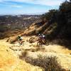
Land Manager: Palos Verdes Peninsula Land Conservancy
 Sullivan-Yedvarts-Cheney-Backbone
22.0 mi 35.4 km • 3,681' Up 1122.1 m Up • 3,681' Down 1121.98 m Down


 Backbone Trail: Will Rogers to Temescal Ridge
14.2 mi 22.8 km • 1,953' Up 595.27 m Up • 1,970' Down 600.39 m Down
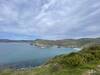
Catalina Island Dirt / Gravel Ride
35.6 mi 57.3 km • 4,463' Up 1360.26 m Up • 4,385' Down 1336.41 m Down
Avalon, CA
 Fullerton Loop
11.2 mi 18.1 km • 669' Up 203.99 m Up • 679' Down 206.81 m Down
Turnbull Canyon
12.0 mi 19.4 km • 2,038' Up 621.26 m Up • 2,037' Down 620.88 m Down
Corral Canyon Out and Back
12.3 mi 19.8 km • 2,095' Up 638.66 m Up • 2,095' Down 638.45 m Down


1 Comment