Dogs No Dogs

E-Bikes
Not Allowed

Dogs are allowed on Alpine Road and Coal Creek Open Space, but not in Russian Ridge. Helmet requirements, 15 mph limit, and other rules in the open space preserves are well enforced, especially on weekends.
Overview
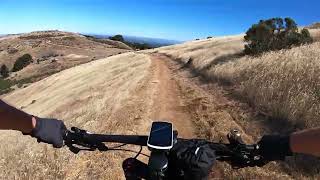
This ride features a good amount of climbing up single and doubletrack followed by some quiet shady pavement. This is followed by an extremely scenic loop of fire road and fun singletrack. Finally, a fun and occassionally challenging downhill ride back to the car.
This loop is mountain bike friendly, but has the full mix of hikers, horseback riders, dogs, and cars -- especially on weekends.
Need to Know
Park out of the way of the gate (note 'Do Not Block Gate' sign). For a longer ride (and less driving), you can park much earlier on Alpine Road and warm up by cruising up the paved part of lower Alpine Road.
Description
Drive to the end of Alpine Road from 280 (or park as early as you like and ride up to the gate). Park at the gate next to the residential entrance (Ciervos Rd), keep clear of the gate to allow passage (note the no parking sign).
Ride up a sustained climb, winding through the woody double and singletrack to Page Mill Road. The old road sections are a moderate grade. The singletrack "bypass" section (required) is steep in places but can be ridden uphill by the determined. Eventually reach the top and turn right on Page Mill Road (paved - not steep) for 0.6 miles. Go across Skyline Blvd, and proceed on Alpine Road (paved - not steep) until it is just about to go downhill. Enter Russian Ridge Open Space on the right (first entrance on the right has a short climb and logs to hop over--if you go another couple hundred feet on Alpine Rd there is another entrance you can ride through), and shortly thereafter turn left onto
Ancient Oaks Trail.
There are lots of options for looping around in Russian Ridge--this loop has some good singletrack, epic views of the bay and ocean, and a couple short climbs. The loop is:
Ancient Oaks Trail ->
Bo Gimbal Trail ->
Ridge Trail ->
Hawk Ridge Trail ->
Alder Spring Trail ->
Charquin Trail -> Skyline Blvd.
Exit at Russian Ridge onto Skyline at the
Vista Point. Turn left (north) on
Skyline Trail and very soon take the first road on the right "
Clouds Rest Road." Go down this semi-paved road to its end and enter Coal Creek Open Space through a gate. Shortly after, veer right at the fork onto
Meadow Trail. Follow Meadow trail down to Alpine Road
Meadow trail has a couple steep and rutty sections to keep you on your toes. It can be a swamp in wet weather and Crazy Pete's Rd.
Trail is preferred (see below).
As an alternative, go a mile further north on
Skyline Trail, turn right on Crazy Pete's Rd.
Trail and enter Coal Creek Open Space at the end of Crazy Pete's Road. Stay left at the fork for a better downhill and eventually reconnect with Alpine Road.
Either way, reconnect with Alpine Road and follow it back downhill to the car.
Note that there are lots of options to this loop including crossing Page Mill and entering Montebello Open Space, taking different routes through Russian Ridge Open Space; or using different combinations of Crazy Pete's, Cloud's Rest or
Meadow Trail through Coal Creek OSP either up or downhill.
Alpine Road is getting overgrown and is effectively singletrack in many places, and recently has sprouted a bunch of sporty kickers. When riding up, watch for downhill traffic, and when riding down be aware of uphill riders, hikers, horseback riders and dogs--all of which are on the trail at times.
History & Background
Alpine Road was built in 1895 because businessmen in San Mateo County wanted more of the lumber and agricultural products from the Skyline Area that was being transported down Page Mill Road to Santa Clara County.
It was open to cars until the 1960s and maintained as a fire road suitable for cars and road bikes until the early 1990s when mudslides in the lower section took out large parts of the road.
Contacts
Shared By:
Brendan Busch
with improvements
by Cole Fenger

 Continue with onX Maps
 Sign in with Facebook


 Intermediate/Difficult

 Old Haul Road Out and Back

 Portola…, CA
 Mid-Peninsula Linkup
 Fremont Older - Wedding


3 Comments