Dogs Unknown

E-Bikes
Unknown

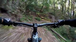
Steven Creek Park has a long stretch of fireroad that you can really fly down, but be on the lookout for hikers and rangers (who can give you speeding tickets)
Overview
This loop provides a nearly continuous trail that spans across seven open space preserves. Starting at the Saratoga Gap parking area, you'll ride through Saratoga Gap, Long Ridge, Skyline Ridge, Russian Ridge, Coal Creek, Monte Bello, Steven Creek, and finish off with a sweet singletrack back down to your car.
I chose to ride clockwise because it seems to maximize the amount of downhill portions on singletracks. But you pay the price by riding up some pretty steep fire roads in Skyline Ridge and Steven Creek.
The route takes you through forests, open ridge tops and even a creek crossing! Each OSP hosts its own network of trails so there is more than one way to do this. If it's your first time biking there, check out the maps at the trailhead to make sure the trail you are taking will link-up to the next park.
If you chose to make Steven Creek your last stop like I did, be aware that you have to ride up
Charcoal Road, which is a steep climb at the end of a long day. Alternatively you can skip Steven Creek and exit out of Monte Bello via Skid Road trail, and return to your car by either going on Skyline Blvd or retracing your route starting from the
Ridge Trail.
Need to Know
Come prepared for a long day of riding. Almost the entire ride is off-road, except for a small section that links up Russian Ridge with Coal Creek via Skyline Blvd. Bring plenty of water if you show up on a hot day - my advice is to start early or come during spring/fall season. Much of Steven Creek is fireroad anyway and would be wet in early season. There will also be a creek crossing at the
Table Mountain Trail turn-off. Watch out of rattlesnake and poison oak as usual. If you ride often around the area you'll know, and there are plenty of signs to remind you of that. Some trails are for hikers only (no bikes allowed) so make sure you read the trail signs.
Description
Park in the lot right beside the intersection of Hwy 9 and Skyline Blvd. The Saratoga Gap trailhead is on the opposite side of the lot. Take
Saratoga Gap Trail all the way until it intersects with Skyline Blvd again (along the trail you'll pass by an open sandy area, do NOT take
Charcoal Road as it is for uphill traffic only).
Cross Skyline Blvd to enter Long Ridge OSP. Take the Hickory Oaks trail along the gorgeous ridgeline, and take the right when you encounter forks on the trail. Eventually you'll see an entrance on your right for
Peters Creek Trail - take that, go through an open "gate" and enjoy some nice singletrack switchbacks. At a fork, keep right to stay on
Peters Creek Trail, then make a left to
Ridge Trail (going right will take you to
Grizzly Flat Trail).
The
Ridge Trail should take you all the way to Russian Ridge OSP through a bunch of road crossings. When you arrive at a picnic area with a parking lot, the trail continues behind a shack at about your 10 o'clock position (it may be hard to see but there is a sign). Continue on
Ridge Trail through singletrack until you pop out to a fire road right next to the hwy. Take a left here and at all subsequent forks. You'll pass by Horseshoe Lake on a small bridge, and very short thereafter a split in the trail - take a left again to go uphill, and this is one of two steep uphill sections. Push through it until you reach Alpine Pond and the Russian Ridge Parking area.
The
Ridge Trail continues through Russian Ridge. At the split where you can turn left to go down Hawk
Trail, turn right to go underneath some power lines and behind a hill, this is a seldom traveled trail that is really fun and takes you all the way to Rapley Ranch Road. Turn right onto the paved road and then right again onto Skyline Blvd.
This is the only section of paved road on this ride. Continue on Skyline until you see Crazy Pete Road to your left. This is the entrance of Coal Creek OSP. If you follow the route shown here, you'll end up popping out at Page Mill Road, and Monte Bello is right across the street. Take the
White Oak Trail and stay right on forks - this is probably the best singletrack portion of the entire ride. You'll cross Steven Creek and come up to an
Skid Road Trail. If you turn right, it takes you back to Skyline Blvd - a worthy option if you are low on energy. Or you can turn left and for Steven Creek County Park.
If you chose to turn left, take
Skid Road Trail, then turn right onto
Stevens Creek Nature Trail, then right onto
Canyon Trail. Ride through mostly fun downhill fire roads until you see a sign for
Table Mountain Trail (should point you back to
Charcoal Road). Cross the creek and start going uphill. There isn't much at this point so when in doubt, go uphill.
Table Mountain Trail is a singletrack but Charcoal road is... a road. Grunt through it and you'll intersect
Saratoga Gap Trail. Turn left at that point and enjoy a well deserved ride back down to your car
Shared By:
Johnny Y

 Continue with onX Maps
 Sign in with Facebook


 Intermediate/Difficult

 Ridge Trail Ride

 Los Alt…, CA
 Arastradero Loop
 El Corte Madera Open Space Loop


3 Comments