MTB Project Logo

A long, sustained climb up to the Main Divide in the Santa Ana Mountains.


Your Rating: Rating Rating Rating Rating Rating      Clear Rating
Your Difficulty:
Your Favorites: Add To-Do · Your List
Zoom in to see details
Map Key

5.4

Miles

8.6

KM

Doubletrack

2,780' 847 m

High

1,099' 335 m

Low

1,812' 552 m

Up

213' 65 m

Down

7%

Avg Grade (4°)

24%

Max Grade (13°)

Dogs Leashed

E-Bikes Allowed

Features Drops/Jumps

Description

Skyline Dr Trail is a popular route up to the Main Divide Rd from Riverside County. It can be accessed at the back of a Corona neighborhood from Lincoln Ave off Foothill Pkwy. Free parking is well-marked on the Foothill Pkwy cul-de-sac (see map).

The trail begins as a paved path off Foothill Pkwy and goes behind the neighborhood for a bit. Then it turns into a fire road after the neighborhood ends. The beginning mile is tame but at the first hairpin turn, the climb begins and is relentless for miles. The grade is relatively sustained with a couple tougher sections. There are several offshoots of popular downhill single tracks that traverse the fire road.

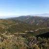
The views of the IE and San Gabriel Mountains are spectacular, especially once you gain some altitude. In the summer, start early because it gets hot. The trail eventually turns into Blackstar Canyon Rd and meets up with the Main Divide Rd shortly after at Beeks Place.

Contacts

Shared By:

Phil Reyes with improvements by Alexander Stewart and 1 other

Trail Ratings

  3.9 from 16 votes

#1

in Corona

#6940

Overall
  3.9 from 16 votes
5 Star
25%
4 Star
44%
3 Star
31%
2 Star
0%
1 Star
0%
Trail Rankings

#1

in Corona

#396

in California

#6,940

Overall
124 Views Last Month
20,914 Since Jan 6, 2015
Intermediate Intermediate

6%
0%
71%
0%
24%
0%

Photos

Looking east at Corona
Aug 30, 2015 near Corona, CA
View of IE and Mt Baldy on the up Skyline Drive. You can see the lower parts of the Skyline Drive Trail on the right.
Jan 6, 2015 near Corona, CA
On Skyline looking at one of the singletracks along this razorback.  Looking northeast.
Sep 6, 2015 near Corona, CA
Looking back down Skyline looking east.  Corona is in the background
Sep 6, 2015 near Corona, CA
At Troy Lee/Skyline junction
Nov 10, 2020 near Corona, CA
Start of the long, nice downhill ride on Skyline Drive (breeze back to your car).
Jan 6, 2015 near Corona, CA
loading

Weather


Current Trail Conditions

All Clear 5 days ago
Add Your Check-In

Check-Ins

May 12, 2023
Robson Grubba
Jul 24, 2022
Adam Linamen
Jul 23, 2022
Adam Linamen
Apr 28, 2022
Pete Ha
Mar 6, 2022
Oscar Alvarez
Feb 22, 2021
Eduardo Lima
Feb 14, 2021
D Rugg
Made it to the doppler without stopping! Long climb! 9.7mi — 1h 09m
Aug 25, 2019
Niv Binymini
Welcome

Join the Community

Create your FREE account today!
Already have an account? Login to close this notice.

Get Started