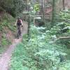
“A short but steep singletrack trail connecting Brush Creek with the Ocoee WWC. ”
0.7
Miles1.2
KMSingletrack

Land Manager: USFS - Cherokee National Forest Office
 Tanasi Trails
36.5 mi 58.7 km • 2,973' Up 906.23 m Up • 2,973' Down 906.3 m Down


 Ducktown, TN
 Cohutta Death March
68.9 mi 110.9 km • 7,609' Up 2319.3 m Up • 7,616' Down 2321.3 m Down


 McCaysv…, GA
 Mulberry Gap: Bear Creek, P1 and P2 Loop
23.6 mi 37.9 km • 3,002' Up 915.03 m Up • 2,963' Down 903.05 m Down


 Chatsworth, GA
 Stanley Gap Loop
14.4 mi 23.2 km • 2,072' Up 631.45 m Up • 2,061' Down 628.27 m Down


 Blue Ridge, GA
 Trail 301 (East - West Loop)
13.9 mi 22.4 km • 2,325' Up 708.55 m Up • 2,324' Down 708.3 m Down


 Chatsworth, GA
 Duncan Ridge Loop
21.0 mi 33.8 km • 2,212' Up 674.15 m Up • 2,217' Down 675.78 m Down


 Blairsv…, GA


0 Comments