This complex of trails can be combined in dozens of ways. An extra 4-5 miles, and 800 vertical feet can be added by rocking the Claremont Loop. You can string together the many trails in differing orders to come up with mileages that are more manageable for novice riders. You can go as little as 8, or as much as 16.
The terrain in Marshall Canyon is remarkable for it's NorCal feel. All around, the hills are hot and dry, but at Marshall the trees keep it shaded and the creek helps keep it cool.
It is legal to ride Marshall Canyon at night, so bring your lights and have a blast! However, don't stray onto the other side of the hill in Claremont, they'll write you a ticket.
Due to this trail's popularity, the neighborhood streets immediately surrounding the entrances are by permit only. Access to the trail requires a small amount of riding on pavement.
Park in the parking lot of Oak Mesa Park, or along Wheeler Ave near the park. Ride along the paved path between the park and the grade school just south of it. Say "hey" to the kids if they're at recess. The concrete terminates at a dirt path, left or right. You can get to the trail either way...
Left from park - Follow the path along the creek for a quarter-mile and turn right onto Via Arroyo, a residential street. 500 feet up the street on the right, hidden between two houses, is an entrance. Slip through the hip-high fence guarding the trailhead and descend a steep little singletrack to the main trail, staying left.
Right from park - Immediately after going right, there is a wooden bridge on the left, cross the creek and turn right on Los Robles, another residential street. In 200 yards the street ends, turn right and immediately left downhill on Orangewood. The trail will be on the left a hundred yards or so down the hill.
Once on
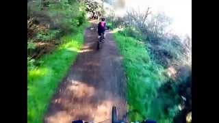
Marshall Canyon Trail, enjoy the amazing beauty of the huge oaks that cover everything. The creek crossings, when it's not too dry, will get your bike really dirty but add to the adventure.
Less than a half-mile in, don't take the uphill right split, this curves up to a residential street.
A mile and a half into the trail, look for a stand-alone horse stable in a low, shaded hollow on the right. This is a common "wait for your slow friends" spot. Shortly after the stable, look for a trail split. To the right, the trail curves up and then quickly left, climbing parallel to the left-hand split. The left is typically where people come downhill.
A short distance later, the wide climbing trail ends at a water tower. Around it to the right is a really fun singletrack, but is almost all downhill traffic. Stay to the left when climbing and roll between the one foot-tall square wood posts embedded in the ground. Through these stumps begins a wide dirt access road that spans one of the few open-sky areas in Marshall Canyon.
About a half-mile from the water tower is another trail split. The left split is a short access spur to a large stable above, the middle is for climbing higher in the canyon, and the right split is the beginning of the
Roller Coaster, the downhill that will eventually wrap around the water tower mentioned earlier.
A few curves later you may notice a tiny sliver of a trail go up and to the left. This is a short, no name singletrack that I've rode both ways, so be careful if you decide to climb it. Otherwise, stay on the wide road and it will eventually curve its way to an intersection with another wide dirt road to the left. This climbs up to another water tower, but it's a dead-end. Stay right, and the trail goes through some really pretty terrain for about a half-mile before reaching a picnic bench beneath a huge, thick canopy of green. This is also where a few trails converge. To the right is
Middle Switchbacks, to the left
Cobal Canyon - La Verne Fire Road resumes its steep climb to the top. The middle trail is
Sidewinder, a short, steep plunge from the top of the canyon.
As you can see, there are many options from this spot. I usually go up to the left and make a right at the top of the canyon on
Sidewinder. Once back to the picnic bench, I go up
Middle Switchbacks to Miller Lateral and turn right. Then I look for
Washout, a singletrack on the right that descends the canyon face to merge again with the very top of
Marshall Canyon Trail.
Now to get back to the car, just follow the smooth turns and berms downhill and eventually you'll need to decide which of the two ways back to the parking lot you want to take.
Rip it up!!!

 Continue with onX Maps
 Sign in with Facebook


 Intermediate

 XC Training Route


 Manker Flat to Lytle Creek via Mt Baldy Notch Shuttle Ride
 CHSP East
 Anaheim Hills Park Trail Loop


 Minor Issues


6 Comments