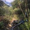
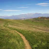
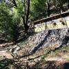
“A tough little singletrack switchback climb, or a fun technical downhill descent. ”
0.4
Miles0.6
KMSingletrack

Land Manager: Los Angeles County Parks and Rec
 Marshall Canyon
10.4 mi 16.8 km • 1,355' Up 413.03 m Up • 1,356' Down 413.43 m Down


 La Verne, CA
 Barrett-Stoddard Shuttle
12.1 mi 19.5 km • 1,222' Up 372.43 m Up • 3,094' Down 942.97 m Down


 San Ant…, CA
 Alternate Bonelli Loop
9.4 mi 15.1 km • 822' Up 250.67 m Up • 823' Down 250.76 m Down


 San Dimas, CA
 CHSP East
13.3 mi 21.4 km • 1,693' Up 515.89 m Up • 1,692' Down 515.83 m Down


 Los Ser…, CA
 Winter Creek Loop
4.9 mi 7.9 km • 1,236' Up 376.75 m Up • 1,245' Down 379.49 m Down


 Sierra…, CA
 Chino Hills Loop
20.0 mi 32.2 km • 2,855' Up 870.09 m Up • 2,854' Down 869.92 m Down


 Yorba L…, CA


0 Comments