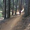
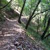
“Relatively flat singletrack to doubletrack with a few small technical sections. ”
1.6
Miles2.6
KMSingletrack

Local Club: Sierra Buttes Trail Stewardship
Jan 24, 2024: Comments Needed for 2024 Downieville Trailwork
Jan 17, 2024: The 2023 SBTS Trails Report: 20 Years, 200 Miles of Trail Built and More Progress On the Way!
Jan 16, 2024: $5 a Foot Has Ended, Thank You to Everyone Who Contributed to Trails!
Land Manager: USFS - Tahoe National Forest Office
 North Yuba Loop
11.0 mi 17.7 km • 2,029' Up 618.37 m Up • 2,023' Down 616.49 m Down


 Downiev…, CA
 Big Boulder from Butcher Ranch Trailhead
19.8 mi 31.9 km • 1,516' Up 461.95 m Up • 5,221' Down 1591.5 m Down


 Downiev…, CA
 Downieville Classic
14.0 mi 22.5 km • 663' Up 202.12 m Up • 4,846' Down 1477 m Down


 Downiev…, CA
 Big Boulder from Gold Valley Rim Trail - IMBA EPIC
21.7 mi 35.0 km • 1,498' Up 456.53 m Up • 5,662' Down 1725.87 m Down


 Downiev…, CA
 Johnsville A-Tree to Downieville First Divide
15.5 mi 24.9 km • 632' Up 192.51 m Up • 4,297' Down 1309.71 m Down


 Clio, CA
 Bullards Bar Loop
15.2 mi 24.4 km • 2,532' Up 771.75 m Up • 2,530' Down 771.15 m Down


 Challen…, CA


0 Comments