MTB Project Logo

This should be your first loop at ECDM. The one loop to rule them all.


Your Rating: Rating Rating Rating Rating Rating      Clear Rating
Your Difficulty:
Your Favorites: Add To-Do · Your List
Zoom in to see details
Map Key

8.0

Miles

12.9

KM

55%

Singletrack

2,375' 724 m

High

1,339' 408 m

Low

1,549' 472 m

Up

1,548' 472 m

Down

7%

Avg Grade (4°)

19%

Max Grade (11°)

Dogs No Dogs

E-Bikes Not Allowed

Features Drops/Jumps · Views

Overview

In this loop, you'll descend arguably the best trail in the preserve - Resolution Trail - while also seeing a few other singletrack gems, and the ever-tranquil creek itself.

Lots of climbing out, but at least you'll end it with a fun, swift, singletrack ride back to your vehicle.

Description

Start out at gate CM02 - near the Methuselah Tree on Skyline Blvd. You can optionally start at gate CM00, in the bigger parking lot. If you do that, simply take the Sierra Morena Trail from its trailhead, heading north.

For CM02, take the rightmost trail - Sierra Morena Trail, heading north/northwest. It starts with a beauty of a steep, short descent - then begins a perfect warm-up climb.

It'll end on Fir Trail (Upper) - take a left. This trail is a highway that flows up and down. Don't be tempted to keep going downhill to the left at the first split in 0.4 miles - we'll later climb up this uppermost part of Manzanita Trail. For now, bend to the right. Nope, don't veer off on to Tafoni Trail (Upper), a little further down.

Another 0.2 miles later, and you'll be at the base of Vista Point. Note the memorial to the lives lost on the aircraft Resolution. The trail you'll be going down was named after this. Clamber to the top of Vista Point and enjoy the view. Count yourself lucky if there is no blanket of fog covering the Pacific.

Roll down Vista Point and take a sharp right, continuing on Fir Trail (Upper) for only 0.1 miles. Go ahead and send it on some of those bumps. At the next clearing, you've reached the trailhead of the amazing Resolution Trail. It'll be on your right.

This is why you came. Lower your seat, and prepare for world-class singletrack technical descent.
You'll encounter rocks, blind corners, roots, rollercoaster-like flow, and turns so fun you'll shout for joy.
Toward the bottom of the trail, as the brush gets thicker, be careful of your speed - you'll soon arrive at the intersection of El Corte de Madera Creek Trail. Stop and rest your legs, or keep flowing to the left.

Send those first, round, rolling jumps as you head down El Corte de Madera Creek Trail. Enjoy the speed - there's a good bit of climbing coming up. You'll cross the creek in a half mile - you should probably get your breath here.

Climbing now, you're still on El Corte de Madera Creek Trail (albeit heading south), keep going up until you see a trail sign on your left. You'll be taking a left on to North Leaf Trail, but you'll first likely take a short breather. You're going to want fresh legs for this frolicking, rolling flow trail.

North Leaf Trail - you'll be starting at the northern trailhead and riding it all the way down to the creek. You'll be flowing, climbing roots, railing corners, and, near the middle and bottom, hitting some jumps at speed if you want. Go ahead. Be brave. You'll love this trail.

Over half a mile later, you'll see two trails off to your right - stay straight on North Leaf. (But take note of South Leaf Trail - you'll want to hit this one later. If you want to hit it it now, it's very fun as an out-and-back. It's a more extreme version of North Leaf, with one black diamond-like drop in the middle of it - but don't worry, that part is very walkable).

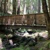
Staying on North Leaf Trail, we'll descend like mad all the way to the bottom - and we'll arrive at the El Corte de Madera Creek Trail and the creek itself. Cross the bridge, sit down and rest. You'll need it. You might also need some more blood sugar at this point for the upcoming climb.

On El Corte de Madera Creek Trail, we'll start a singletrack climb on loamy, grippy soil. Watch out for millipedes, banana slugs and newts. This will quickly turn into a fire road climb that will last a while, but hey, it's worth the price you pay for all that world-class singletrack. You'll have a lot of time for sightseeing as you pedal.

You're going to stay on this trail for about 2.5 miles. Don't take Giant Salamander or Fir Trail (Lower) for now.
Near the top, take Manzanita Trail to the left - a short climb back to Fir Trail (Upper) - take a right.

Take a right on Sierra Morena Trail and enjoy a brisk singletrack adventure back to the gate where you started. You've just completed one of the best loops in the Bay Area.

History & Background

The Resolution trail may have first been cut to get to the plane crash site. Vista Point was apparently a clearing the crew made as a base of operations.

Contacts

Shared By:

Rob Baker with improvements by Chris M

Trail Ratings

  4.1 from 7 votes

#2254

Overall
  4.1 from 7 votes
5 Star
43%
4 Star
43%
3 Star
0%
2 Star
14%
1 Star
0%
Recommended Route Rankings

#283

in California

#2,254

Overall
19 Views Last Month
1,865 Since Dec 19, 2020
Intermediate/Difficult Intermediate/Difficult

0%
0%
13%
75%
13%
0%

Photos

Methuselah Trail, Skeggs Point
Feb 4, 2015 near Woodside, CA
Bridge crossing /bottom of the loop.
Sep 4, 2020 near Woodside, CA
It was a pleasant sight to spot other MTBrs after seeing no one for hours during a cold a rainy day.
Oct 16, 2016 near Woodside, CA
Creek Crossing at the base of the decent
Jul 12, 2017 near Woodside, CA
Climb done, time to start North Leaf!
Dec 20, 2020 near Woodside, CA
switchbacks
Feb 2, 2022 near Woodside, CA

0 Comments

Weather


Current Trail Conditions

Bad / Closed 96 days ago
Add Your Check-In

Check-Ins

May 20, 2023
Lukasz Kuczera
Awesome trail 7.3mi — 1h 36m
Jul 6, 2022
Quentin Torgerson
Apr 18, 2021
Jeongkeun Lee
9.5mi
Apr 15, 2021
Jazvelez
Mar 14, 2021
Justin Ross
7.4mi — 8h 00m
Welcome

Join the Community

Create your FREE account today!
Already have an account? Login to close this notice.

Get Started