Starts at Rockridge BART. Alternately, you can start at Ashby BART if on the Richmond line if you want to save the transfer hassle. Adds about two miles and little to no time.
Climbs on pavement mostly via a mix of cycling lanes, cycletracks, paved paths, and roads with few motorists. It generally follows the former Sacramento Northern electric interurban rail route. The paved path segments are on the rail bed itself.
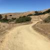
The dirt starts at the Skyline Gate in Redwood Regional Park and does not stop for 20 miles. It roughly follows contour on
West Ridge Trail,
Castle Park Trail, and
Sequoia Bayview Trail with the steepest parts connecting the the first two. The connector from
Sequoia Bayview Trail back into Redwood Regional Park is a nice drop with a quite technical short bit of high timbered steps. There are various ways across to the south edge of Redwood Park from here. Angling left hits
Dunn Trail, which makes the most of the bit of elevation loss. If you miss that turn though any of the routes ahead end up where you need to go.
A short jog right on Redwood Road hits
Skyline Boulevard. Turn left on Skyline on the trail in the median. The median is narrow here and the trail is just along the northbound left turn lane of the road. So take your time and pick your moment to make the turn as the motorists waiting in the lane may think you are about to ride the wrong way in the lane. You are not though. Rather, you hop the curb almost at the point of the median and hit the trail.
From here, it is a fun 3.5 miles of singletrack. As stated in the description of that trail, there are periodic road crossings via curb hops. Take your time to look forward and back to check for motorists that might potentially turn to cross over the median at these locations. You do not have the right of way. Just past halfway along this segment the more obvious trail drops right down to the street. This connects to the top of
Artemisia in the adjoining Leona Canyon Regional Preserve, which provides a means to short the ride and out to Coliseum BART. That misses the most downhill part of the
Skyline Boulevard median singletrack though. To stay on the ride and hit that, take the less-worn and obvious left fork where the trail drops right. It seems like this will put you head-on into northbound motorists, but the trail turns again with a reasonable buffer from the road.
Eventually, the Skyline median ends and you cross over the southbound lanes to a fire road to the west of
Skyline Boulevard. A bit less than half a mile ahead look for the Chabot Equestrian Center. This is a decision point. The ride laid out heads on to cut over the canyon to the east to pick up more singletrack. Or you can stay on the fire roads and trails along
Skyline Boulevard and head for San Leandro or Coliseum BART via one of various possible routes.
To continue on this ride though, cut left off the fire road and cross the northbound lane of
Skyline Boulevard to the entrance to the Equestrian Center. Then turn right on the singletrack. This goes down to the
Goldenrod Trail. Simply follow the route laid out or find your own. If you follow the route, just two potentially tricky bits come to mind.
Lower Redtail Trail connects to
Upper Redtail Trail via a crossing Marciel Road. The road is wide here with parking areas and turnouts on both sides and the trail connection is unmarked. Just forge ahead with confidence and you'll pick up the trail entrance on the far side. The other tricky bit is the bridge crossing over an inlet to Lake Chabot. It is narrow between the handrails. And the width varies. More fun to turn right just ahead of the bridge and cross the inlet on ground. It is dewatered in the dry time of year and only bottom bracket, not axle, deep most others.
One of the best parts of riding auto-free via rapid transit is getting to leave it all on the trail without having to regain coherence for driving. Rather collapse into BART and enjoy the high.

 Wildcat Canyon Loop


 Pinole Ridge Multi-Use Trail

 Continue with onX Maps
 Continue with Facebook


4 Comments