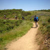
“A utilitarian grind up up or drop down connecting crest and canyon bottom. ”
0.7
Miles1.2
KMDoubletrack

Local Club: Bicycle Trails Council of the East Bay
Land Manager: East Bay Regional Park District (CA)
 Redwood Regional Park - "Official Bike Trail"
8.8 mi 14.1 km • 1,101' Up 335.72 m Up • 1,106' Down 336.99 m Down


 Oakland, CA
 MacDonald-Goldenrod Loop
7.8 mi 12.6 km • 1,339' Up 408.11 m Up • 1,346' Down 410.26 m Down


 Moraga, CA
 Best of Dunsmuir Trails
4.6 mi 7.4 km • 804' Up 244.97 m Up • 790' Down 240.86 m Down


 San Lea…, CA
 Joaquin Miller Park Standard XC Loop
6.0 mi 9.6 km • 694' Up 211.65 m Up • 756' Down 230.38 m Down


 Oakland, CA
 Las Trampas Madrone Loop
7.4 mi 11.9 km • 1,317' Up 401.46 m Up • 1,317' Down 401.4 m Down


 Alamo, CA
 City Mouse, Cross Country Mouse (auto free)
41.6 mi 67.0 km • 4,917' Up 1498.85 m Up • 4,913' Down 1497.52 m Down


 San Fra…, CA


0 Comments