
 Continue with onX Maps
 Continue with Facebook


 Difficult


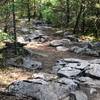
“A technical trail with a couple of big drops. ”


2.6
Miles4.2
KMSingletrack


0 Comments