
 Continue with onX Maps
 Continue with Facebook


 Easy
Easy

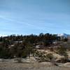
“The Sinton Trail is a paved, multi-user path that is part of the Colorado Springs urban trail network. ”


3.2
Miles5.2
KMPaved Path
 Easy
Easy
Land Manager: City of Colorado Springs
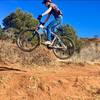
 Pulpit Rock Beginner Tour
8.2 mi 13.3 km • 820' Up 249.99 m Up • 827' Down 251.98 m Down

 Palmer Technical Loop
7.3 mi 11.7 km • 661' Up 201.57 m Up • 672' Down 204.88 m Down

 Ute Valley Loop
4.0 mi 6.5 km • 285' Up 87.02 m Up • 277' Down 84.52 m Down
D-Loop #5
12.3 mi 19.7 km • 1,064' Up 324.25 m Up • 1,063' Down 324.05 m Down
Cimarro…, CO
 LPC After Work Ride
5.3 mi 8.5 km • 686' Up 209.09 m Up • 686' Down 209.23 m Down
Roundup Trail Loop at Red Rock Canyon Open Space
3.5 mi 5.7 km • 432' Up 131.55 m Up • 439' Down 133.83 m Down


 All Clear


0 Comments