
 Continue with onX Maps
 Sign in with Facebook


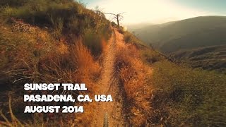
 Difficult
Difficult
Difficult
 Difficult
Local Club: Mount Wilson Bicycling Association
Land Manager: USFS - Angeles National Forest Office
 Mt. Wilson Shuttle
6.9 mi 11.1 km • 193' Up 58.73 m Up • 4,876' Down 1486.28 m Down

 Super Strawberry
25.5 mi 41.1 km • 2,639' Up 804.51 m Up • 5,130' Down 1563.76 m Down
 Altadena, CA
Strawberry Peak Loop
Altadena, CA
Strawberry Peak Loop
15.6 mi 25.0 km • 2,593' Up 790.29 m Up • 2,603' Down 793.49 m Down
Altadena, CA
Millard Canyon Loop
9.0 mi 14.4 km • 1,586' Up 483.33 m Up • 1,580' Down 481.72 m Down
 Gabrielino Trail: JPL to the USFS Dam
8.8 mi 14.1 km • 577' Up 175.77 m Up • 578' Down 176.14 m Down
La Caña…, CA
Chilao Figure-8 Loop
15.2 mi 24.5 km • 2,250' Up 685.74 m Up • 2,248' Down 685.34 m Down


1 Comment