MTB Project Logo

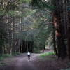
A deep, dark, woodsy hillside trail that passes near the site of a 1953 plane crash.


Your Rating: Rating Rating Rating Rating Rating      Clear Rating
Your Difficulty:
Your Favorites: Add To-Do · Your List
Zoom in to see details
Map Key

1.0

Miles

1.6

KM

Singletrack

2,207' 673 m

High

1,753' 534 m

Low

487' 148 m

Up

33' 10 m

Down

10%

Avg Grade (6°)

17%

Max Grade (10°)

Dogs No Dogs

E-Bikes Unknown

Description

The Resolution Trail is a favorite in the Corte Madera area. It offers world-class descending and climbing.

Descending this trail may be the single most popular ride in the park - it offers everything from gorgeous, side-of-the-hill singletrack, to roots, rocks, and thrilling corners. It's easy to find: heading from upper Fir Trail to lower, it's right after Vista Point.

To climb Resolution Trail, starting from the junction with the El Corte de Madera Creek Trail, climb steadily out of the dark canyon to the lighter, brighter canopy. Sections of level trail are interspersed with moderate inclines on twisty, technical singletrack. The terrain on Resolution changes from dirt trails at the bottom to rocky surfaces at top, making the last part of the incline extra challenging. At a sharp switchback left, the Resolution Trail begins to ascend at a somewhat steeper grade. The trail becomes rocky, and one area is stripped of topsoil, leaving a sandstone surface. The sloping chaparral-covered hillside permits a rare view south, to a swath of conifers. The Resolution Trail ends at a T junction with Fir Trail (Upper) and Fir Trail (Lower).

The Resolution Trail is named after a DC-6 airplane which crashed into the side of this mountain in October 1953. Eight crew members and eleven passengers died in the accident. It was flying a leg of its route from Sydney to Vancouver and was attempting to land in San Francisco in heavy clouds/fog. The crash and fire destroyed the airplane and left debris strewn throughout the forest. Sharp-eyed folks might see a few twisted scraps of metal, but it is illegal (and very disrespectful) to remove any artifacts from the site. The crash site is about halfway along the Resolution trail on the west/downhill side. A memorial is located at the base of Vista Point.

Contacts

Shared By:

Megan W with improvements by Rob Baker

Trail Ratings

  4.5 from 22 votes

#674

Overall
  4.5 from 22 votes
5 Star
55%
4 Star
45%
3 Star
0%
2 Star
0%
1 Star
0%
Trail Rankings

#51

in California

#674

Overall
5 Views Last Month
2,549 Since Feb 2, 2015
Difficult Difficult

0%
0%
0%
15%
85%
0%

Photos

It was a pleasant sight to spot other MTBrs after seeing no one for hours during a cold a rainy day.
Oct 16, 2016 near Woodside, CA
Staring out at the Pacific.
Dec 20, 2020 near Woodside, CA
Sometimes the ocean IS visible!
Dec 20, 2020 near Woodside, CA
sunset on rock garden
Feb 2, 2022 near Woodside, CA
rocks
Feb 2, 2022 near Woodside, CA
The gateway to Resolution. At the top.
Dec 20, 2020 near Woodside, CA
loading

Weather


Current Trail Conditions

Unknown
Add Your Check-In

Check-Ins

Aug 26, 2023
Karen Chaltikian
Tree down on Resolution in the forest section past the rock garden
Mar 1, 2021
Blair Rushing
Dec 14, 2019
R. Gon
Jun 24, 2018
Chris M
Interesting climb. Rolling uphill through chunk is fun. I will have to go back and master all the tech sections. 1mi
Welcome

Join the Community

Create your FREE account today!
Already have an account? Login to close this notice.

Get Started