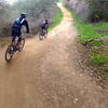
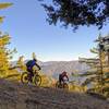
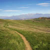
“A dirt access road for authorized vehicles, bikes, and hiking only. ”
1.5
Miles2.3
KMDoubletrack

 Powder Canyon
6.7 mi 10.8 km • 1,165' Up 355.22 m Up • 1,167' Down 355.65 m Down


 Rowland…, CA
 7th St Loop
3.0 mi 4.9 km • 576' Up 175.55 m Up • 579' Down 176.45 m Down


 Haciend…, CA
 Mt. Wilson Enduro Loop
32.5 mi 52.3 km • 6,479' Up 1974.7 m Up • 6,487' Down 1977.37 m Down


 Monrovia, CA
 CHSP East
13.3 mi 21.4 km • 1,693' Up 515.89 m Up • 1,692' Down 515.83 m Down


 Los Ser…, CA
 Winter Creek Loop
4.9 mi 7.9 km • 1,236' Up 376.75 m Up • 1,245' Down 379.49 m Down


 Sierra…, CA
 Irvine Regional Park
7.9 mi 12.7 km • 1,294' Up 394.34 m Up • 1,294' Down 394.26 m Down


 Villa Park, CA


0 Comments