MTB Project Logo

One of the best one-way rides off of Cascade Lakes Highway to town


Your Rating: Rating Rating Rating Rating Rating      Clear Rating
Your Difficulty:
Your Favorites: Add To-Do · Your List
Zoom in to see details
Map Key

18.2

Miles

29.3

KM

100%

Singletrack

5,948' 1,813 m

High

3,870' 1,180 m

Low

534' 163 m

Up

2,451' 747 m

Down

3%

Avg Grade (2°)

15%

Max Grade (9°)

Dogs Unknown

E-Bikes Unknown

Overview

There are a number of rides that start high and bring you back to town, this one is totally doable in an afternoon. Despite the downhill appearance of the vertical profile, the first several miles of this trail regularly undulates up and down. Don't be fooled by the deceptive appearance, it takes some work and time to pedal these forested, flowing miles of intermediate singletrack. If you start late in the day, bring lights, it gets dark in the forest.

Description

Start at Swampy Lakes Sno-Park and head to Swede Ridge. The trail has a few branches soon after departing the parking lot. Follow the GPS track to get directly to Swede Ridge however, all of the trails are fun and can eventually lead you back to Swede, but be ready to ride more. Also, if you are looking for Swampy Lake, err toward looking for the lowland marshy area, not a lake.

After gaining Swede Ridge, the trail has a short section of steeper downhill, then it's totally easy with gorgeous views peeking out on the North side. A short side hike at the intersection of Swede Ridge and Sector 16 trail leads you to the Swampy Shelter, more great views toward Tumalo.

Sector 16 is a curvy, downhill, rooted section of the ride. It goes up and down, eventually leading you to the Shooting Star Shelter, one of the most remote in the area.

Next, you'll ride Upper Whoops which is a fast and fun blue run that leads you to the Lower Whoops trail.

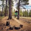
Lower Whoops is one of the local favorites, it has plenty of table tops, along with an assortment of features. This is a one-way (downhill) trail, and you'll soon see why.

The end of Lower Whoops feeds onto to road NF-300, with a new connection on the EXT Trail. Head to the right until Phil's trail begins to the left. Phil's will take you the remaining way to the trailhead.

The entire ride is easy to find, and there are many other variations that bring you back to town, just look at the map. Also, Cog Wild has shuttles that drop you at Swampy or other locations, otherwise you're doing your own car shuttle.

Contacts

Shared By:

Katy Ryan

Trail Ratings

  4.5 from 22 votes

#695

Overall
  4.5 from 22 votes
5 Star
59%
4 Star
32%
3 Star
9%
2 Star
0%
1 Star
0%
Recommended Route Rankings

#26

in Oregon

#695

Overall
7 Views Last Month
15,796 Since Aug 12, 2013
Intermediate Intermediate

0%
14%
86%
0%
0%
0%

Photos

The 'six-pack' near the end of Lower Whoops.
May 21, 2013 near Deschut…, OR
My favorite shot of Alex G on Lower Whoops
Nov 26, 2013 near Deschut…, OR
Bend local Kirt Voreis airs it out over some of the jumps on Lower Whoops near Bend, Oregon.
May 21, 2013 near Deschut…, OR
Alex G doing some bar-dragging on Lower Whoops
Nov 26, 2013 near Deschut…, OR
Alex G near the end of Lower Whoops
Nov 26, 2013 near Deschut…, OR
Alex G near the end of Lower Whoops
Nov 26, 2013 near Deschut…, OR

0 Comments

Weather


Current Trail Conditions

Unknown
Add Your Check-In

Check-Ins

Aug 26, 2023
Rachel Smith
Oct 15, 2021
Joshua Siverson
Great trail! — 1h 56m
Sep 1, 2021
sss S
Aug 17, 2021
Robert Phillips
Epic downhill singletrack on the first half of the ride. I'll be back for more! 18.2mi — 2h 45m
Aug 17, 2021
Robert Phillips
Nov 1, 2020
James McGuire
Swampy to bottom of Lower Whoops. 11.1mi — 2h 46m
Aug 6, 2020
Josh R
Jul 14, 2019
Michelle (Kona) Olson

Stewarded By

Welcome

Join the Community

Create your FREE account today!
Already have an account? Login to close this notice.

Get Started