
 Continue with onX Maps
 Continue with Facebook


 Intermediate/Difficult
Intermediate/Difficult
Intermediate/Difficult
 Intermediate/Difficult
Land Manager: California State Parks - Henry W. Coe State Park
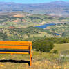
 Mississippi Lake Ride
36.7 mi 59.1 km • 5,281' Up 1609.76 m Up • 5,281' Down 1609.71 m Down

 Coyote Valley Open Space Preserve
3.9 mi 6.3 km • 592' Up 180.46 m Up • 593' Down 180.72 m Down
Mayfair Ranch-Longwall Canyon-Bald Peaks-Catamount
8.0 mi 12.9 km • 1,645' Up 501.34 m Up • 1,646' Down 501.84 m Down
 Almaden…, CA
Mine Hill Loop
Almaden…, CA
Mine Hill Loop
6.1 mi 9.8 km • 1,155' Up 352.04 m Up • 1,152' Down 351.23 m Down
Best of Nisene
18.6 mi 30.0 km • 1,951' Up 594.76 m Up • 1,945' Down 592.72 m Down
Montgomery Hill Loop
3.0 mi 4.8 km • 427' Up 130.28 m Up • 424' Down 129.24 m Down


 All Clear


2 Comments