
 Continue with onX Maps
 Continue with Facebook


 Intermediate

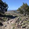
“A fun and sometimes steep descent from near Wilson Peak to Grizzly Gulch Trail. ”


0.9
Miles1.4
KMSingletrack
 Intermediate
Land Manager: California State Parks - Henry W. Coe State Park
 South Henry Coe Singletrack Tour
27.8 mi 44.8 km • 6,143' Up 1872.51 m Up • 6,153' Down 1875.36 m Down
 San Martin, CA
 Road Runner to Razorback
5.2 mi 8.4 km • 702' Up 213.88 m Up • 702' Down 214.09 m Down
Mine Hill Loop
6.1 mi 9.8 km • 1,155' Up 352.04 m Up • 1,152' Down 351.23 m Down
Rancho San Vicente and Calero Park
9.4 mi 15.2 km • 713' Up 217.45 m Up • 713' Down 217.24 m Down
 Almaden…, CA
Santa Teresa County Park - Full Tour
Almaden…, CA
Santa Teresa County Park - Full Tour
13.9 mi 22.4 km • 2,122' Up 646.9 m Up • 2,104' Down 641.2 m Down
Montgomery Hill Loop
3.0 mi 4.8 km • 427' Up 130.28 m Up • 424' Down 129.24 m Down


0 Comments