
 Continue with onX Maps
 Continue with Facebook


 Difficult


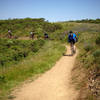
“Gunshot connects Brown Bridge (top of White Hill) to Loma Alta (Smith Ridge) with a brutal climb! ”


0.8
Miles1.2
KMDoubletrack
 Difficult
Local Club: Marin County Bicycle Coalition
Land Manager: Marin Municipal Water District
 China Camp State Park Loop
8.7 mi 14.0 km • 772' Up 235.44 m Up • 772' Down 235.27 m Down
Santa V…, CA
 To Tamarancho and Beyond (auto free)
30.4 mi 48.9 km • 4,394' Up 1339.17 m Up • 4,364' Down 1330.16 m Down
San Rafael, CA
 Tennessee Valley to Muir Beach Short Loop
12.6 mi 20.3 km • 1,973' Up 601.51 m Up • 1,975' Down 601.86 m Down
Tamalpa…, CA
Tennessee Valley to Horseshoe Bay
8.6 mi 13.8 km • 1,145' Up 348.94 m Up • 1,343' Down 409.2 m Down
Angel Island
10.3 mi 16.5 km • 731' Up 222.74 m Up • 731' Down 222.71 m Down
Havey Trail Loop
5.2 mi 8.3 km • 1,044' Up 318.24 m Up • 1,050' Down 319.93 m Down


0 Comments