
 Continue with onX Maps
 Continue with Facebook


 Intermediate

 Intermediate
Land Manager: USFS - Plumas National Forest Office
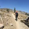
 Big Boulder from Gold Valley Rim Trail - IMBA EPIC
21.7 mi 35.0 km • 1,498' Up 456.53 m Up • 5,662' Down 1725.87 m Down
 Downiev…, CA
 Scott's Flat Lake Trail - Short Loop
9.0 mi 14.5 km • 829' Up 252.67 m Up • 830' Down 252.86 m Down
Nevada…, CA
Old Miners' Loop from Town
10.4 mi 16.8 km • 1,266' Up 385.85 m Up • 1,272' Down 387.6 m Down
Hole in the Ground Loop
16.5 mi 26.6 km • 2,003' Up 610.56 m Up • 1,974' Down 601.8 m Down
Truckee, CA
DLRT (Donner Lake Rim Trail) Castle Valley to Donner Ridge
8.3 mi 13.3 km • 1,222' Up 372.58 m Up • 1,008' Down 307.31 m Down
Truckee, CA
 Royal Gorge Hewlett Rim Trail
14.1 mi 22.8 km • 1,573' Up 479.47 m Up • 1,573' Down 479.57 m Down


1 Comment