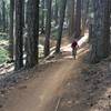
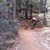
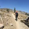
“A challenging, steep, and technical descent to the Downie River. ”
3.3
Miles5.3
KMSingletrack

Local Club: Sierra Buttes Trail Stewardship
Jan 24, 2024: Comments Needed for 2024 Downieville Trailwork
Jan 17, 2024: The 2023 SBTS Trails Report: 20 Years, 200 Miles of Trail Built and More Progress On the Way!
Jan 16, 2024: $5 a Foot Has Ended, Thank You to Everyone Who Contributed to Trails!
Land Manager: USFS - Plumas National Forest Office
 Downieville Classic from Butcher Ranch
12.6 mi 20.2 km • 538' Up 164.06 m Up • 4,224' Down 1287.39 m Down


 Downiev…, CA
 Big Boulder from Gold Valley Rim Trail - IMBA EPIC
21.7 mi 35.0 km • 1,498' Up 456.53 m Up • 5,662' Down 1725.87 m Down


 Downiev…, CA
 Mt. Hough Huff and Puff
24.5 mi 39.5 km • 4,352' Up 1326.63 m Up • 4,350' Down 1325.89 m Down


 East Qu…, CA
 Scott's Flat Lake Trail - Short Loop
9.0 mi 14.5 km • 829' Up 252.67 m Up • 830' Down 252.86 m Down


 Nevada…, CA
 Hole in the Ground Loop
16.5 mi 26.6 km • 2,003' Up 610.56 m Up • 1,974' Down 601.8 m Down


 Truckee, CA
 Royal Gorge Hewlett Rim Trail
14.1 mi 22.8 km • 1,573' Up 479.47 m Up • 1,573' Down 479.57 m Down


 Truckee, CA


0 Comments