MTB Project Logo

A classic West Shore ride - big climb, big rocky technical descent, big views!


Your Rating: Rating Rating Rating Rating Rating      Clear Rating
Your Difficulty:
Your Favorites: Add To-Do · Your List
Zoom in to see details
Map Key

15.3

Miles

24.6

KM

80%

Singletrack

8,425' 2,568 m

High

6,251' 1,905 m

Low

2,215' 675 m

Up

2,220' 677 m

Down

5%

Avg Grade (3°)

25%

Max Grade (14°)

Dogs Off-leash

E-Bikes Allowed

Overview

Stanford Rock is a big, long, sometimes punishing, climb followed by a great technical descent on "old school" singletrack with lots of rocks and steps. It's great for those who like technical descents and can handle lots of rock steps.

The climb is mostly forested with some great views along the second half of the climb. Be sure to stop here and there on the descent on the Tahoe Rim Trail - Tahoe City to PCT/Granite Chief Wilderness/Twin Peaks. There are some amazing views of Twin Peaks, the Pacific Crest, epic fields of alpine wildflowers, aspen groves etc. Bring a camera!

Need to Know

Be prepared! Carry tools, pump, tube. It's a long hike out to Ward Creek Road. Tubeless tires or high pressure is recommended for the descent. Practice sound risk management, especially your first time down. Have fun!

Description

We start this ride in Ward Creek State Park, just off the bike path along Hwy 89 on the Ward Creek-Stanford Rock Connector. The traditional start to this ride was on Ward Creek road and started with an immediate creek crossing followed by an immediate climb. Start with dry feet and an easy warm-up with this version.

From the Ward Creek-Stanford Rock Connector, make a left at the old logging road, Stanford Rock Trail, and start climbing! Most of the climb follows a decommissioned logging road and is steep in parts. The climb is one of the harder continuous climbs in the Tahoe Basin. You'll be climbing for about 5.5 miles with few breaks. It is 100% rideable but a challenge to clean the whole thing.

Just past the first large open meadows, there is a nice view spot overlooking Lake Tahoe, Blackwood Canyon, and into Desolation Wilderness. Check it out and keep climbing!

The top of the climb is obvious and has amazing views. Prepare for the descent!

Make a right turn onto the Tahoe Rim Trail - Tahoe City to PCT/Granite Chief Wilderness/Twin Peaks at the "T" intersection (where the trail flattens out after the first descent) and descend toward Ward Creek Road (going straight will bring you into Granite Chief Wilderness and the PCT/TRT). Everything on the descent is rideable but requires some low-speed rock descending, picking good lines, and local knowledge. Look out for lots of steps!

Ride cautiously, check out sections on foot if you aren't sure about the lines, and practice good risk management. The descent is 100% rideable once you see the line. There is no training benefit to an endo on sharp granite! It's a fun but technically challenging descent on an old school trail.

The trail turns into old fire road after the Ward Creek, TRT bridge. Follow the old road downhill until it dumps you off onto Ward Creek Road. It's an easy downhill road burn back to the start, just head toward toward the lake and you'll find your way back.

History & Background

Check out the waterfall next to the trail! Also, stop in the first big meadow on the descent. Great views of Twin Peaks, the Sierra Crest, Aspens, wildflowers, etc.

TAMBA (Tahoe Area Mountain Bike Association) volunteers, in cooperation with the Forest Service, completed a partial reroute of the descent in Fall 2015. "The Corkscrew," an unsustainable fall line downhill trench, was rerouted into sweet flowing singletrack to the TRT intersection (with some rock features and banked turns!). TAMBA is currently working on permission to realign parts of the climb as well to turn this into a world class loop.

Contacts

Shared By:

S. Lengyel with improvements by Bob Ward and 1 other

Trail Ratings

  3.9 from 17 votes

#7

in Lake Tahoe

#1739

Overall
  3.9 from 17 votes
5 Star
35%
4 Star
35%
3 Star
18%
2 Star
12%
1 Star
0%
Recommended Route Rankings

#7

in Lake Tahoe

#218

in California

#1,739

Overall
22 Views Last Month
14,684 Since May 11, 2016
Difficult Difficult

0%
0%
0%
13%
75%
13%

Photos

Near the top of the climb (looking back) on the Stanford Rock trail.
Aug 13, 2016 near Sunnysi…, CA
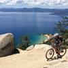
Epic views from the climb!  Tahoe, South Shore, Blackwood Canyon, Rubicon Peak, Desolation Wilderness.
May 11, 2016 near Sunnysi…, CA
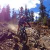
Did I mention the steps? Kevin Joell (TAMBA president emeritus) rides the waterfall steps on a hardtail.
May 11, 2016 near Sunnysi…, CA
Smokey, Tamarack fire..
Jul 25, 2021 near Sunnysi…, CA
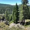
View of the Sierra Crest from the top of the climb!
May 11, 2016 near Sunnysi…, CA
Top of the climb. Prepare for descent! Check out this crazy rock first though. Looks like a piece of obsidian blown out of a volcano!
May 11, 2016 near Sunnysi…, CA
loading

Weather


Current Trail Conditions

Unknown
Add Your Check-In

Check-Ins

Aug 22, 2022
brian c
16mi — 5h 12m
Jul 25, 2021
brian c
Aug 16, 2020
Eloy Lopez
Jul 27, 2020
Steve Monson
Trail is in fine condition. 15.3mi — 3h 00m
Jul 24, 2020
Greg Ovalle
Amazing ascent not extreme from an incline basis but can be very technical. Beyond fun on way down - lists of rolling berms and. Banked turns
Jul 22, 2020
Tony Trentacosti
Jul 12, 2020
Stefan Aprodu
16.4mi — 2h 26m
Nov 14, 2018
Jonathan Coupal
A refaire je ferais aller/retour!
Welcome

Join the Community

Create your FREE account today!
Already have an account? Login to close this notice.

Get Started