Dogs Unknown


As of summer 2021, Spooner Lake park is completely closed and fenced off until September 2021. The only access to this trail is via the dirt lot at the intersection of 28 and 50. The sign there indicates it is a hiking entrance only, and that mountain bikers should proceed 1/2 mile north to the Spooner Lake entrance. However, that entrance is closed with a fence across it.
For details, see:
parks.nv.gov/news/main-entr…
Overview
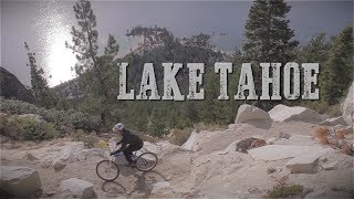
The Flume trail is considered to be one of the absolute must-do rides in the Tahoe area, and this ride is a popular way to ride that trail and hit a few other awesome spots along the way.
The "difficult" rating is due to some challenging climbs and the overall distance of this ride, but many intermediate riders would find this technically doable as long as they're prepared to be on their bike for several hours.
The ride as mapped starts from Spooner Lake State Park, heads up the
North Canyon Road, then descends the famous Flume Trail, then curves around to return south on the Tahoe Rim Trail, meeting back up with
North Canyon Road and returning to the start point.
Need to Know
There is also a very popular shuttle service that makes several runs a day from Spooner Lake State Park to/from a cafe on Tunnel Creek road (the northernmost point of this ride). After riding the Flume Trail, you can make a left on Tunnel Creek Road for an easy cruise to the shuttle pickup, rather than riding the entire Tahoe Rim Trail portion.
Description
This ride starts out from Spooner Lake State Park. Find parking here at the northern edge of the park, and start out on
North Canyon Road. This is the main road that will take you to The Flume Trail. Drop down onto
North Canyon Road and follow the road uphill (north) for 3.6 miles where you'll come to the base of a pretty steep section of the trip. This section is about 1/2 a mile, and 300 ft. of vertical gain. This is the steepest section of trail, and once done it is downhill to Marlette Lake and the start of the Flume Trail.
Just before the top of this climb you'll see an optional road on your right that will take you to the top of Snow Valley Peak. This climb is for the expert rider only. It is very loose, and steep. It is a 1.5 mile climb with 1100 ft of climbing to the top. The view is spectacular, but it's difficult to get there.
Continue due north on North Canyon Jeep Trail and you'll drop back down to a 4 way intersection. Take a left and follow the trail around the south end of Marlette Lake. This will eventually lead into the Flume Trail.
This trail is enjoyable, mostly flat singletrack twisting along a steep mountain side dropping only 40' per mile. If you're afraid of heights, this ride might not be for you, but it's an intermediate trail otherwise, and an incredible one at that. The views are spectacular and the riding is flowy and fun.
The first section is very technical, and many riders walk this section. It is very short, and once you clear it, the ride gets much easier. From here, the singletrack swings out on the side hill and gives you a great view of Lake Tahoe. Follow the singletrack north for 4.2 miles (10.5 miles) where you'll intersect Tunnel Creek Road.
This is the point where you can make a left to get a shuttle pickup, but for this ride, take a right to head east to the Tahoe Rim Trail. In this section of the ride, you'll encounter a torturous 900' climb with many... no... VERY many obstacles.
The climb rewards you with an opening to another meadow with spectacular views at Marlette Peak. Here you'll find a couple hundred foot diversion to a view point. Enjoy the view of Tahoe & Marlette Lakes. Continue back to the trail and descend 500' to Marlette Lake.
When the trail hits Marlette Lake Rd. take a right to continue riding around the lake. Eventually, you'll come to the same 4-way intersection you came to earlier in the ride, at the southern end of the lake. Straight ahead would take you back around for another descend on the Flume Trail, but this time, head left to get back on the
North Canyon Road.
Cruise down the remaining 4.5 miles or so back to your car and look at all the amazing pictures you took along the way!
Contacts
Shared By:
Michael Ahnemann
with improvements
by Matt Hawkins
and 1 other

 Continue with onX Maps
 Sign in with Facebook


 Intermediate/Difficult

 Tahoe Rim: Spooner to Town

 Indian…, NV
 Carson Marlette Fire Road
 Kings Beach Short Loop


 Bad / Closed


2 Comments