Dogs Leashed

Family Friendly
The Orange and Purple trails are built beginner-friendly. Approx. 85% of the Blue Trail can be navigated by beginners as well as the new Green Trail. If in doubt, dismount and walk it.

Closed for 24-hours after any significant rains. Call the park Ranger station for closure information: 706-557-3001
All trails are 'directional', depending on the day of the week, except for the Connector Trail (purple)
Horses are not allowed. The park has 22-miles of trails just for you.
Overview
There are 5 hand-built, old-school, cross-country style trails within this system. None of these trails are of the machine-groomed smoothness found in typical urban settings so are a little rough.
The current trails are:
- Orange Loop - Beginner level loop - 1.0-mile - This trail will introduce riders to typical conditions to expect in the system including roots, rocks, twisty sections and a small hill.
Purple Connector Trail - Beginner level - 0.5-mile each way - Relatively smooth flowing through an open forest with a small hill. - Blue Loop - Beginner/Intermediate level loop - 4.75-miles - Very scenic with (4) cascading creek sections located between the rolling hills. A favorite for trail runners and hikers, too.
- Green Loop - Beginner/Intermediate level loop, a little harder than Blue but not as pretty. This trail is a combination of Blue and Red with a little of everything...short climbs, creek crossing, tight/twisty and fast/flowy and enough distance to challenge many riders.
- Red Loop - Intermediate/Advanced level loop - 5.25-miles - This is the main workout trail of the more experienced riders that come to TT it periodically to gauge fitness. There are several longish climbs and fast descents, tight/twisty and fast/flowy sections. Nothing too technical, it will surprise you how it beats you up...
Need to Know
The trails are marked with color-coded signs and arrows, the color matching the particular trail you're on. There are also waypoint numbers on arrow signs approximately every 0.50-miles that correspond to the trail maps, available at the trailhead kiosk and Park Trading Post, so that you can monitor your location at any time.
Description
The recommended route for experienced riders will total around 17-miles. The system is 'directional', depending on the day of week. Below is the latest cue sheet info...
Even Days (Sunday, Monday, Wednesday, Friday) for ALL Riders:
- From the parking lot, enter the ORANGE Trail
- After 30, turn LEFT at the trailhead
- After .55-miles, turn LEFT onto the PURPLE Trail
- Following the Purple arrows, when you reach the dirt road (1/4-mile), turn LEFT, cross the culvert then turn LEFT to reenter the trail.
- After 20, continue straight up the hill to the RED/BLUE Trailhead (~.3-miles away)
Experienced Riders: (~16-mile ride) - At the RED/BLUE trailhead, turn LEFT onto the RED Trail.
- Follow the RED arrows in a 5.15-mile loop back to the same trailhead.
- Turn LEFT onto the BLUE Trail and follow the appropriate BLUE Arrows (depending on day of week) for 5-miles. When you reach the dirt road (the 2nd time), go straight across the road and enter the GREEN Trail.
- Follow the GREEN arrows for 5-miles till you reach the dirt road again.
- To return to the parking lot, turn LEFT, reentering the PURPLE Trail, cross the culvert and turn RIGHT, following the Purple arrows.
- After ~.2-miles, bear LEFT and reenter the ORANGE Trail and ride .45-miles to the parking lot.
- Or, at the GREEN trailhead, go straight across the dirt road onto the PURPLE Trail to do it, or parts of it, over againanimal!
Odd Days (Saturday, Tuesday, Thursday) for ALL Riders:
- From the parking lot, enter the ORANGE Trail
- After 30, turn RIGHT at the trailhead
- After .45-miles, turn RIGHT onto the PURPLE Trail
- Following the Purple arrows, when you reach the dirt road, turn LEFT and cross the culvert
Experienced Riders: (~16-mile ride) - At the GREEN trailhead, turn RIGHT onto the GREEN Trail. Follow the GREEN arrows 5-miles. There are two bail-out shortcut options along the way. (at Miles 1.5 and 3)
- When you reach the dirt road, go straight across to enter the BLUE Trail and follow the appropriate BLUE arrows for 5-miles to the RED/BLUE Trailhead.
- Turn RIGHT and follow the RED arrows in a 5.15-mile loop back to the same trailhead.
- To return to the parking lot, turn RIGHT, reentering the PURPLE Trail and follow the Purple arrows
- After ~.5-miles, turn RIGHT to reenter the ORANGE Trail and ride .55-miles to the parking lot.
History & Background
This park was built in the 1930's by CCC workers as a training ground for local farmers to learn proper drainage control in their planted fields. An old quarry is near the trails where granite was removed and used to build stone dams and culvert systems and can be seen at various places along the trails.
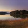
The park has 24-miles of specific equestrian trails, a 2-mile hiking trail and large full service campground. There are two lakes, one ideal for kayaking and with a very nice beach area and boat launch.
Contacts
Shared By:
Bill Pflueger
with improvements
by Brendon Carrasquillo
and 1 other

 Continue with onX Maps
 Continue with Facebook


 Intermediate

 Fort Yargo Mountain Bike Trail

 Winder, GA
 Hawkes Creek - Red, White, and Blue


5 Comments