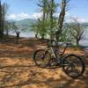
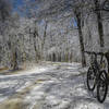
“A steep trail both directions! ”
0.9
Miles1.5
KMSingletrack

Local Club: Southern Appalachian Bicycling Club (SABA)
Land Manager: USFS - Nantahala National Forest Office
 Jackrabbit Mountain
11.3 mi 18.1 km • 693' Up 211.12 m Up • 692' Down 211.07 m Down


 Hayesville, NC
 Upper 'Hooch Loop
16.0 mi 25.7 km • 2,335' Up 711.56 m Up • 2,341' Down 713.52 m Down


 Cleveland, GA
 Duncan Ridge Loop
21.0 mi 33.8 km • 2,212' Up 674.15 m Up • 2,217' Down 675.78 m Down


 Blairsv…, GA
 Flint Ridge
2.1 mi 3.4 km • 259' Up 78.92 m Up • 235' Down 71.5 m Down


 Robbins…, NC
 Eight Gaps
20.2 mi 32.5 km • 2,635' Up 803.09 m Up • 2,628' Down 800.95 m Down


 Dahlonega, GA
 2019 Fools Gold 50
55.3 mi 89.0 km • 7,329' Up 2233.97 m Up • 7,297' Down 2224.19 m Down


 Dahlonega, GA


0 Comments