
 Continue with onX Maps
 Continue with Facebook


 Easy/Intermediate

“A moderate fire road trail providing access to a hilltop vista. ”


1.2
Miles1.9
KMDoubletrack
 Easy/Intermediate
Land Manager: Midpeninsula Regional Open Space
 Rocks with Ox
10.0 mi 16.0 km • 1,809' Up 551.45 m Up • 1,808' Down 551.12 m Down


 El Corte Madera Open Space Loop
11.5 mi 18.4 km • 2,051' Up 625.02 m Up • 2,051' Down 625.04 m Down
Portola…, CA
 Purisima Creek Grand Loop
19.1 mi 30.7 km • 4,273' Up 1302.54 m Up • 4,279' Down 1304.21 m Down
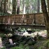
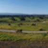
 Vista Slope
4.0 mi 6.4 km • 236' Up 71.91 m Up • 238' Down 72.46 m Down
Ridge Trail Ride
14.9 mi 24.0 km • 2,380' Up 725.47 m Up • 2,380' Down 725.37 m Down
Los Alt…, CA
Long Ridge Loop
6.0 mi 9.7 km • 689' Up 210.04 m Up • 689' Down 209.93 m Down
Saratoga, CA


 Bad / Closed


0 Comments