MTB Project Logo

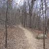
A moderately rocky trail with a few technical spots winding through the woods.


Your Rating: Rating Rating Rating Rating Rating      Clear Rating
Your Difficulty:
Your Favorites: Add To-Do · Your List
Zoom in to see details
Map Key

2.6

Miles

4.2

KM

Singletrack

815' 248 m

High

709' 216 m

Low

183' 56 m

Up

215' 66 m

Down

3%

Avg Grade (2°)

11%

Max Grade (6°)

Dogs Off-leash

E-Bikes Unknown

Description

Head left from the parking lot down the red-blazed trail. This trail continues left or branches off right (the beginner trail) continue left down a fairly fast flow section with a few obstacles. The trails winds around as you descend through the woods.

You'll approach a small rock garden, followed by a "caution" sign indicating the first of three creek crossings. It's a fairly technical descent followed by a fairly steep (but short) rocky incline. At the top of the hill, the path breaks off to the left (expert trail, clearly marked) or continues to the right meeting up with the intermediate trail (clearly marked).

The trail continues through a fairly flat section surrounded by tall grass until you reach the second creek crossing followed by the most technical climb of the trail. After the climb the trail continues winding through the woods following the lay of the land up and down some fairly easy hills until you reach to third creek crossing.

From this crossing, the trail continues with the last part a fun, flow-y roller coaster-like section with a few technical area sprinkled in. The trail finally joins the beginner trail until it reaches the parking lot at the end after a decent climb back to the gravel parking lot.

note: Officially the trail starts off on the east side of the parking lot, and should be ridden in that direction, but riding it in "reverse" offers its own challenges and rewards.

Follow this link for the original map of the keystone lake mountain bike trails, on the Oklahoma Earth Bike Fellowship. okearthbike.com/trails/trai…

Contacts

Shared By:

Tim Welch

Trail Ratings

  3.5 from 2 votes

#22008

Overall
  3.5 from 2 votes
5 Star
0%
4 Star
50%
3 Star
50%
2 Star
0%
1 Star
0%
Trail Rankings

#166

in Oklahoma

#22,008

Overall
2 Views Last Month
533 Since Dec 31, 2014
Difficult Difficult

0%
0%
0%
50%
50%
0%

0 Comments

Weather


Current Trail Conditions

Unknown
Add Your Check-In

Check-Ins

Nov 23, 2018
Peder Horner
Clockwise loop from trailhead, covered with leaves, made it a little more sketchy. Trails are in good shape, however. Good cyclocross bike trail. 4.6mi
Welcome

Join the Community

Create your FREE account today!
Already have an account? Login to close this notice.

Get Started