Dogs Unknown

E-Bikes
Not Allowed
Features
Views

A National Forest Adventure Pass is NOT required any longer to park at the trailhead. Instead there are envelopes and a place to drop the money and a label to put on your windshield. No fee is required if you park off the pavement on Paradise Road or Camusa Road.
Overview
This is the best, and hence the most popular, intermediate trail in the Santa Ynez River area. It combines a fire road climb, A singletrack section that will have you smiling from ear to ear, and an easy paved spin back to your car.
If you are in the area and only have time for one ride this is the one to do! You won't regret it!
Need to Know
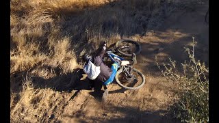
Be careful on both the dirt road and the paved road. ATV's and motorcycles use the dirt road. Listen for their approach and stay out of the way. On weekends there can be significant traffic from the many picnickers and fisherman along the Santa Ynez River. Be especially careful once back on the paved road.
While you are in the area make sure to check out the many nearby swimming holes in the Santa Ynez. You can drive up the road and find one to your liking or ask the locals where the more hidden holes lie.
During the rainy season the road is frequently gated at the river crossing just west of the Lower Oso paring area. You can still ride these trails but use EXTREME caution should you choose to cross the river. The water can be fast and the footing is very slick. Also remember that if you cross the river EMS will have much more difficult time assisting you in case of an emergency.
Finally - Use a bell to alert others to your presence.
Description
Park at the Lower Oso Picnic area. Begin by taking the
Lower Oso Trail up through the valley. It crosses back and forth across the road and makes a more interesting alternative to ridng the pavement. Once the trail ends find your way to the Upper Oso Trailhead. Skirt the right side of the large metal gate and begin your trip up the Buckhorn/Big Pine Road.
The dirt road starts off gradually with only a gentle incline for about the first 0.75 of a mile. Once the
Santa Cruz Trail is passed on your left the gradient increases significantly. The steepest sections of the road come low in the ride but the grade never fully eases off. Wind your way up the road enjoying the views into the Santa Barbara backcountry. About 2.5 miles after going around the locked gate the road reaches a large flat area and the start of the
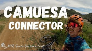
Camuesa Connector Trail.
The Camuesa Connector trail takes off east from the Big Pine Buckhorn Road. There are no junctions or turns to make, just fast and fun singletrack. There are a few Rocky sections that can easily be walked, and some exposure you'll want to be wary of, but most of the trail is very suitable to the intermediate rider.
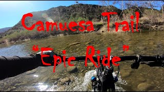
4 miles comes too soon as the trail drops down and crosses the Santa Ynez River before ending at Paradise Road. Turn right and cruise about 2.5 miles back to your car. If you're looking for an alternative to the road, try to pick up the river trail just on the left after the first river crossing on Paradise Road.
Contacts
Shared By:
Kevin Fox
with improvements
by Michael Sebastian
and 5 others

 Continue with onX Maps
 Continue with Facebook


 Intermediate/Difficult

 4.3 (42)


 Bad / Closed


9 Comments