Continue with onX Maps
 Sign in with Facebook


Hiking Santa Barbara
 CA
CA- Southern California
- Hiking Santa Barbara


Overview
A gem among California beach towns, Santa Barbara lies at a geographical transition zone between Central and Southern Coastal California, The region has a mild and inviting Mediterranean climate ideal for year-round hiking and outdoor exploration. Between the south-facing coastline and Channel Islands lying offshore offshore and a backdrop of the rugged Santa Ynez Mountains rising above town the scenery is spectacular. For those looking for more remote and off the beaten path experiences, the Los Padres National Forest to the north covers a huge swath of the coastal mountains with longer loops, ridgelin hikes, backcountry camping and more. Myriad parks and open spaces sprinkled throughout the towns and surrounding county land means you don't have to travel or drive far to access trails.
If you are looking for abundant flowing water or waterfalls, winter and early spring is the best time to get out as summer through fall are often hot and dry in the coastal mountains around Santa Barbara, and seasonal creeks frequently dry up with flows reduced greatly. If venturing out into the Los Padres backcountry, make sure to carry more water than you think you'll need. Temperatures here are often 90-degree plus and mapped water sources are often dry.
Visiting Tips
Santa Barbara's mild climate affords comfortable hiking conditions along the coastline pretty much throughout the year. Fog can be an issue May through July (have you heard the saying, "May grey" or "June gloom?"), limiting views along the coast for the first half of the day and often burning off for the afternoon, although sometimes the fog lingers all day. Getting up higher on the mountain ridges will often get you above the fog if you are looking for sun.
Caution: when off the coast, temperatures can be oppressively hot from late spring through summer and into early fall once you get further inland over the first coastal ridge and up into the Los Padres National Forest. If hiking inland or on longer routes in the Los Padres, make sure to hike early and bring plenty of extra water as waters sources are often seasonal and dry outside of winter/early spring.
Once the rain hits, however, hiking in late winter and early spring in the mountain canyons and Los Padres can be magical when creeks and waterfalls are flowing, wildflowers blooming and California's "green season" is in full swing.
Camping & Lodging
Santa Barbara is chock-full of mid to high-end lodging options as the town itself caters to tourism. Slightly more affordable lodging options are more readily available in both the towns of Carpenteria and Ventura to the south.
If you're looking to camp, consider one of the state beach campgrounds along the Gaviota Coast west of Santa Barbara (at El Capitan State Beach, Refugio Sate Beach, or Gaviota State Beach) or at Carpenteria State Beach to the south. Some fun glamping options can be found at El Capitan Canyon across Highway 101 from El Capitan State Beach.
Recommended Routes in Hiking Santa Barbara - 17
MTB Project is built by riders like you. Add Your Recommended Routes


 Difficult
Romero Loop
10.2 mi 16.5 km • 2,366' Up 721.14 m Up • 2,364' Down 720.68 m Down

 Summerland, CA

 Intermediate/Difficult
Camuesa Connector Loop
10.6 mi 17.0 km • 1,559' Up 475.12 m Up • 1,558' Down 474.74 m Down
Mission…, CA
 Difficult
Jesusita Out and Back
6.8 mi 10.9 km • 1,323' Up 403.18 m Up • 1,323' Down 403.19 m Down
 Difficult
Tequepis Trail
7.8 mi 12.5 km • 2,325' Up 708.51 m Up • 2,324' Down 708.25 m Down
Santa Ynez, CA

 Intermediate
The Elings Loop
5.2 mi 8.4 km • 726' Up 221.22 m Up • 715' Down 218 m Down
 Intermediate/Difficult
Girard/McMenemy DH
1.4 mi 2.2 km • 45' Up 13.85 m Up • 751' Down 228.82 m Down
Montecito, CA
 Intermediate/Difficult
Cold Springs Loop
13.6 mi 21.9 km • 3,072' Up 936.47 m Up • 3,076' Down 937.48 m Down
Montecito, CA

Hiking Santa Barbara Biking
- 226 Miles 364 Kilometers of Trail
- 17 Recommended Routes
- 1
Easy Trail

- 50
Intermediate Trails

- 27
Difficult Trails

Areas Within Hiking Santa Barbara
Weather Averages
|
High
|
Low
|
Precip
|
Days w/
|
| J | F | M | A | M | J | J | A | S | O | N | D |
Trails in Hiking Santa Barbara - 61
MTB Project is built by riders like you. Add Your Trails
|
3.9
mi
6.3
km
#1Camuesa Connector Trail
Intermediate/Difficult
Mission Canyon, CA
|
Intermediate/Difficult
|
Mission Canyon, CA |
8
|
|
|
1.3
mi
2.1
km
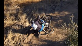
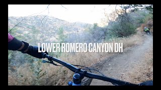
#2Lower Romero
Difficult
Summerland, CA
|
Difficult
|
Summerland, CA |
17
|
|
|
2.0
mi
3.2
km
#3San Antonio Creek Trail
Intermediate
Mission Canyon, CA
|
Intermediate
|
Mission Canyon, CA |
22
|
|
|
6.6
mi
10.7
km
#4Romero Fire Road
Intermediate
Summerland, CA
|
Intermediate
|
Summerland, CA |
14
|
|
|
1.5
mi
2.4
km
#5West Fork Cold Spring
Intermediate/Difficult
Mission Canyon, CA
|
Intermediate/Difficult
|
Mission Canyon, CA |
8
|
|
|
4.5
mi
7.3
km
#6Cold Spring Trail - South
Difficult
Montecito, CA
|
Difficult
|
Montecito, CA |
11
|
|
|
2.5
mi
4.0
km
#7Sweetwater Trail
Intermediate
Santa Ynez, CA
|
Intermediate
|
Santa Ynez, CA |
10
|
|
|
2.4
mi
3.9
km
#8Arroyo Burro Trail
Intermediate/Difficult
Mission Canyon, CA
|
Intermediate/Difficult
|
Mission Canyon, CA |
6
|
|
|
4.5
mi
7.3
km
#9Santa Cruz Trail
Difficult
Mission Canyon, CA
|
Difficult
|
Mission Canyon, CA |
7
|
|
1.0
mi
1.5
km
#10Inspiration Point Trail
 Very Difficult
Mission Canyon, CA
|
Very Difficult
|
Mission Canyon, CA |
3
|
Photos of Hiking Santa Barbara - 111
MTB Project is built by riders like you. Add Your Photos