
 Continue with onX Maps
 Continue with Facebook


 Difficult
Difficult
Difficult
 Difficult
Local Club: Central Coast Concerned Mountain Bikers
Land Manager: San Luis Obispo County Parks
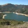
 Duna Vista Loop
7.6 mi 12.2 km • 973' Up 296.46 m Up • 975' Down 297.26 m Down

 Nipomo, CA
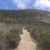
 Spring Trail from Alternate Parking
4.3 mi 7.0 km • 511' Up 155.64 m Up • 510' Down 155.43 m Down
Pismo B…, CA
Valley View Loop
3.3 mi 5.2 km • 393' Up 119.74 m Up • 395' Down 120.28 m Down
Oats Peak Trail
11.3 mi 18.2 km • 1,433' Up 436.67 m Up • 1,438' Down 438.39 m Down
Los Osos, CA
East Boundary-Hazard Peak-Manzanita
12.5 mi 20.2 km • 1,678' Up 511.35 m Up • 1,676' Down 510.74 m Down
Los Osos, CA
Quarry Short Loop
2.3 mi 3.7 km • 385' Up 117.22 m Up • 384' Down 116.97 m Down


3 Comments