
 Continue with onX Maps
 Continue with Facebook


 Difficult


 Difficult
Land Manager: California State Parks - Mount Diablo State Park
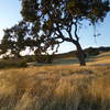
 Paraiso Trail Loop
3.4 mi 5.5 km • 676' Up 205.97 m Up • 682' Down 207.84 m Down
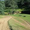
Ohlone-Crystyl Ranch Loop
5.5 mi 8.9 km • 757' Up 230.7 m Up • 767' Down 233.68 m Down
 Creek Loop
6.8 mi 11.0 km • 777' Up 236.78 m Up • 779' Down 237.49 m Down
Diablo, CA
 Las Trampas Madrone Loop
7.4 mi 11.9 km • 1,317' Up 401.46 m Up • 1,317' Down 401.4 m Down
Around Round Valley
7.6 mi 12.2 km • 474' Up 144.58 m Up • 474' Down 144.38 m Down
Pinole Ridge Multi-Use Trail
9.7 mi 15.6 km • 1,132' Up 345.1 m Up • 1,131' Down 344.79 m Down


2 Comments