
 Continue with onX Maps
 Continue with Facebook


 Very Difficult

 4.5 (4)

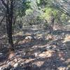
“This trail takes you straight up the backside of Decision Point with a 45% grade. ”


0.4
Miles0.6
KMSingletrack


0 Comments