Dogs Unknown

E-Bikes
Not Allowed

No e-bikes.
Overview
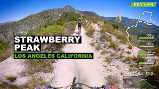
This ride takes you up and around Strawberry Peak following an almost endless descent via the Gabrielino
Trail to JPL.
Need to Know
This ride is designed to be shuttled to Josephine Peak trailhead and ridden back down via the
Gabrielino Trail (NRT) Arrange for drop-off via friend or shuttle van service. Prepare to be on your bike for 3 - 4.5hrs, take plenty of water before you go... Lots of tight, technical, steep and lose terrain with exposure, know your physical and technical abilities before you plan to ride.
Description
This trail is a shuttle to the trailhead start arrange for drop off and pick up before you go.
Start your ride at
Josephine Peak Road trailhead off to the south of Angeles Crest Hwy (Hwy-2). The actual trailhead is just a short distance north on FH-59 and will be off to the right.
+Take
Josephine Peak Road 2.6 miles and climb to the Josephine / Strawberry Saddle trail junction, on the RIGHT you'll see the singletrack trail entrance (DO NOT continue on the fire road on the left)
+Strawberry Saddle and
Colby Canyon Trail will meet up go (SLIGHT LEFT) to stay on
Colby Canyon Trail. From here you'll round the mountain and enjoy some scenic mountain views, fresh pine trees and some sweet but sketchy singletrack.
+ You'll eventually arrive at Strawberry Meadows follow the trail markers on the huge boulders marked "TRAIL" with a Native American arrows. A mile down you'll arrive at a sign in box (there's usually nothing inside) keep right, and you'll know you're going the right way when trail shoots up, at this point you'll reach a sustained climb that gets steep and later gets easier as you go. The trail will finally take you down a fast a flowy descent to Hwy 2 and the Redbox Ranger Station at the bottom.
+Cross HWY 2 and head toward the Redbox Ranger Station. Rest up.
+Make your way down the
Gabrielino Trail (NRT) or "Redbox trail" The doubletrack will turn into a singletrack a few miles down, keep an eye out for poodle-dog bush and all types of natural terrain obstacles. This trail has a short but challenging rock garden get past it and you're done with the "hard part" of the trail. Continue to Switzer Picnic Area and chill out a bit.
+From the Switzer Picnic Area, make your way down to Commodore Camp and Switzer Falls area it's very rocky be careful. IMPORTANT! Stay right when you reach the "Y" intersection Gabrielino
Trail junction! Do not go left! That trail will take you down into to the falls and that's not where you want to go unless you don't mind climbing back up.
+The next junction is at the bottom of the
Ken Burton Trail.
DO NOT go up Ken Burton trail! Parallel the Arroyo all the way, ride the river bed and pay attention to the colorful trail marker or follow the mtb tire tracks.
+Follow the trail marker flags and begin your climb up and over the Arroyo Seco dam - a short but punchy climb - then hang a left at the bottom where you'll hit the USFS monument. Enjoy the flowy trail through streams, Gould Mesa campground, and eventually the JPL parking lot.
History & Background
The Gabrielino
Trail was built in 1970 by the USFS and named after the Tongva Native Americans who inhabited the area for nearly 3,500 years. During early Spanish rule, they named the natives Gabrielinos and the name stuck.
The trail today is used by hikers and mountain bikers alike and it's maintnance duties are conducted by the USFS, CORBA and the MWBA. The North end of this trail was abandeoned after the station fire in 2009 and even before then saw very little use due to it's lack of maintnance, today the trail is being restored by mountain bike clubs and volunteers with a strong will to ride and hike it once more.
Contacts
Shared By:
Eddie Spaghetti
with improvements
by Carson Blaker
and 1 other

 Continue with onX Maps
 Sign in with Facebook


 Difficult

 Sunset Ridge / El Prieto Loop from Millard Campground

 Altadena, CA
 Mt. Lukens from the Fire Station
 La Tuna Loop


 Minor Issues


3 Comments