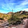
“Enjoy great views while riding the crest. ”
1.4
Miles2.2
KMSingletrack

Land Manager: Maricopa County Parks
 Estrella Rainbow to Pederson to Butterfield Loop
16.9 mi 27.1 km • 1,240' Up 377.88 m Up • 1,246' Down 379.73 m Down


 Goodyear, AZ
 Sunrise South Butte Loop
7.3 mi 11.8 km • 1,015' Up 309.48 m Up • 1,015' Down 309.31 m Down


 Sun Cit…, AZ
 Deem Hills Ridge Loop
5.2 mi 8.3 km • 839' Up 255.74 m Up • 839' Down 255.67 m Down


 Anthem, AZ
 Prickly Pedal Race Course
40.6 mi 65.3 km • 2,722' Up 829.7 m Up • 2,066' Down 629.82 m Down


 New River, AZ
 Sonoran Long Figure 8
10.5 mi 16.9 km • 1,091' Up 332.5 m Up • 1,082' Down 329.82 m Down


 Anthem, AZ
 Phoenix Sonoran Preserve North/South Loop
13.0 mi 20.9 km • 459' Up 140.02 m Up • 456' Down 139.1 m Down


 Cave Creek, AZ


0 Comments