
 Continue with onX Maps
 Continue with Facebook


 Difficult


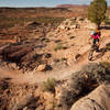
“One of many connecting doubletrack routes in the Monitor and Merrimac area. ”


3.5
Miles5.6
KMDoubletrack
 Difficult
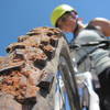
Land Manager: BLM Utah - Moab Field Office
 Bar-M Loop
7.9 mi 12.8 km • 289' Up 88.1 m Up • 284' Down 86.55 m Down
 Beginner Klonzo Loop
5.8 mi 9.4 km • 677' Up 206.22 m Up • 681' Down 207.46 m Down
Moab Brand Trails - Lazy/EZ Loop
3.7 mi 6.0 km • 181' Up 55.1 m Up • 181' Down 55.2 m Down
 Moab, UT
 Hey Joe - Spring Canyon Loop
38.7 mi 62.3 km • 2,551' Up 777.41 m Up • 2,547' Down 776.22 m Down
Jug Handle Loop
37.5 mi 60.4 km • 3,247' Up 989.62 m Up • 3,249' Down 990.36 m Down
Moab, UT
Klondike Bluff Outer Loop
14.6 mi 23.5 km • 1,213' Up 369.86 m Up • 1,214' Down 369.89 m Down


 Minor Issues


0 Comments