
 Continue with onX Maps
 Continue with Facebook


 Intermediate

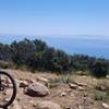
“The most direct way to or from the ridge. ”


1.5
Miles2.4
KMDoubletrack
 Intermediate
Local Club: Central Coast Concerned Mountain Bikers
Land Manager: City of Santa Maria - Recreation and Parks
 Race Course Loop
6.3 mi 10.1 km • 616' Up 187.83 m Up • 603' Down 183.75 m Down


 Davy Brown Loop
11.2 mi 18.0 km • 2,456' Up 748.64 m Up • 2,481' Down 756.11 m Down
Gaviota Loop
4.5 mi 7.2 km • 789' Up 240.52 m Up • 791' Down 241.03 m Down
Gaviota Peak - Trespass DH
6.9 mi 11.1 km • 2,198' Up 669.8 m Up • 2,213' Down 674.66 m Down
 Spring Trail from Alternate Parking
4.3 mi 7.0 km • 511' Up 155.64 m Up • 510' Down 155.43 m Down
Pismo B…, CA
Tequepis Trail
7.8 mi 12.5 km • 2,325' Up 708.51 m Up • 2,324' Down 708.25 m Down
Santa Ynez, CA


0 Comments