This is an easier introduction to many of the singletracks in the Bull/!Jake Mountain Trail complex. You'll miss the classic
Bull Mountain and
Bare Hare trails, but you'll not miss the extra 1000 ft of climbing and 10 miles of riding (or perhaps you'll).
Steer Mountain will still leave you with plenty of red-clay, rock-and-root filled singletrack with some short, pithy climbs and descents as well as a number of creek crossings including one that is typically about 3 feet deep and 20 feet wide. It includes older more rustic singletracks as well as newer flowy sections. If you can't commit to the IMBA Epic ride for whatever reason, this will give you a taste of the area.
Of all the North Georgia Trails (with the possible exception of the Dawson Forest area), the Bull/!Jake Mountain trails seem by far the most popular among equestrians. Be sure to yield the right-of-way and be thankful that they do a fair amount of trail maintenance in this trail system.
Most of the trail intersections are well marked with forest service signage, but there are a fair number of intersections so having a GPX from the
MTB Project mobile app will prevent you from having to stop at each one to read this verbose description for directions.
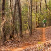
I prefer to do this in the clockwise section as shown because it saves the knee-deep creek crossing for the end of the ride. Most of the trail is under hardwood and pine forest canopy, so you can count on a shaded ride in the summer.
From the Jake Mountain trailhead, take the
Bull Mountain Connector and keep left at the intersection just beyond the parking area. The trail is well contoured and after a short initial climb, it's mostly downhill to
FS28-1. You can carry some speed, but do watch for horses.
Turn right onto
FS28-1, which is a wide forest service road suitable for passenger cars. You've got two miles of warm up on this trail until you reach the intersection with
Winding Stair Gap Road FS77. Turn left at the fork to start climbing
Winding Stair Gap Road FS77 and after a few hundred feet you'll reach a parking area which is the former Game Check station.
Across from the Game Check station, you'll find an entrance to
Upper Moss Creek. This singletrack is a little more rustic with rocks and some ruts and takes you up to
Jones Creek Dam Trail (223E). This begins the most sustained climb of the loop and takes you to the high point on the ride at about 2000 ft. Unfortunately, there isn't much of a view because of the heavy tree cover. From the high point at 4.2 miles, you've got a moderately steep, rocky descent down to an intersection of several forest roads and trails. This is a fun, fast descent if you're not riding the brakes.
At this intersection, cross
Winding Stair Gap Road FS77 onto the
Turner Creek singletrack. This is a narrow singletrack with some root-strewn sections, which parallels Turner Creek for a distance. Towards the end, you'll climb almost all the way back to
Winding Stair Gap Road FS77, but just before you get there take a sharp right onto
No-Tell trail.
No-Tell is mostly a doubletrack that is closed to vehicular traffic. There are a couple of old cemeteries along the route to the left if you aren't going too fast to see them.
No-Tell takes you to
FS28-1 after a moderate climb and a fast descent.
The loop picks up on the other side of
FS28-1 with
Black Branch.
Black Branch starts as a very rocky doubletrack that is slowly turning to singletrack as it continues downhill. There are a couple places you can catch air in this stretch if you like. After about a mile, the tread becomes a pure singletrack with fewer rocks. There's a couple of creek crossings and then you begin climbing back towards
FS28-1. Before you get there,
Black Branch merges with an old forest road and just before you reach
FS28-1, you should turn left on the
Jake Mountain singletrack.
The
Jake Mountain singletrack is the highlight of the loop. This trail was significantly rerouted/rebuilt several years ago and it's well contoured and very flowy with climbs that are not too steep but still steep enough to make you work. There are two trail intersections (with
Nimblewill Branch Trail (223K) and
Lower Moss Creek), where you'll have to make sharp left turns to stay on
Jake Mountain.
At the 13.6-mile mark, you'll reach the knee-deep crossing of Jones Creek which is refreshingly cool in the summer or freezing in the winter. After that, you've got about 300 ft of climbing in the next mile followed by another mile of relatively flat riding to cool down before you reach the trailhead.

 Continue with onX Maps
 Continue with Facebook


 Intermediate

 2019 Fools Gold 50

 Dahlonega, GA
 Upper 'Hooch Loop
 UNG Oakwood MTB Trail
 Chicopee Woods Intermediate Loop


 Minor Issues


2 Comments