
 Continue with onX Maps
 Continue with Facebook


 Easy/Intermediate

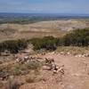
“East/west connector. The western half of this trail is used as the exit route for rides on both upper and lower trails. ”


1.2
Miles2.0
KMSingletrack
 Easy/Intermediate
Local Club: Paonia Singletrack Society (PSS)
Land Manager: BLM Colorado - Uncompahgre Field Office
 MJ Loop
6.4 mi 10.3 km • 763' Up 232.42 m Up • 761' Down 232.01 m Down

 Sidewinder Trail
18.6 mi 29.9 km • 2,864' Up 872.99 m Up • 2,048' Down 624.14 m Down
 Orchard…, CO
Old Grand Mesa Downhill Shuttle Run
Orchard…, CO
Old Grand Mesa Downhill Shuttle Run
14.5 mi 23.3 km • 75' Up 22.72 m Up • 3,554' Down 1083.12 m Down
 Sunset Rocks
6.7 mi 10.8 km • 1,048' Up 319.53 m Up • 1,063' Down 324.03 m Down
Coal Creek to Thompson Link Up
24.2 mi 39.0 km • 4,239' Up 1292.02 m Up • 4,264' Down 1299.68 m Down
Colorado Trail: The Entire MTB Route - IMBA EPIC
549.3 mi 884.0 km • 71,117' Up 21676.5 m Up • 69,664' Down 21233.6 m Down
Roxboro…, CO


0 Comments