Dogs Unknown

E-Bikes
Not Allowed
Features
Commonly Bikepacked

Wilderness areas are detoured as mountain bikes are not allowed in the Wilderness.
Overview
The Colorado Trail can be a life-changing experience if you let it! The mountain bike version detours Wilderness Areas, where mechanized travel is off-limits, and can be done any number of ways: from weekend warrior-ing it a couple segments at a time, to a supported through-ride with a sag vehicle, to bikepacking it unsupported in a single push. Because the Wilderness detours pass through several towns where food resupply and motels abound, the Colorado Trail is particularly well suited for a bikepacking adventure of epic proportions. In fact, the route described here has been traversed solo and self-supported in an astonishing 3 days, 23 hours and 38 minutes by Jefe Branham of Gunnison in 2012.
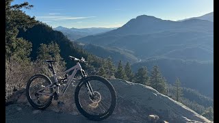
With over 300 miles of singletrack, hardly any of which is flat, you'll encounter nearly every style of riding imaginable: loads of swoopy fast trail, many rocky, rooty, technical climbs and descents, miles of pine-needle covered singletrack, some nearly unrideable talus, and a prodigious amount of hike-a-bike. The route averages over 10,000 feet in elevation, so you'll also spend an immense amount of time at high altitude. In fact, the section from Spring Creek Pass to Stony Pass Road spends almost 30 consecutive miles above timberline! This piece of trail is beautiful and it's an amazing place to be on a gorgeous day, but it can also be extremely dangerous and scary if you are caught there in one of Colorados notorious afternoon thunderstorms.
Bike Sections
Need to Know
For the most part, the trail is very well marked, however, the
Colorado Trail Foundation (CTF) publishes a pocket-sized "Trailside Databook" that contains elevation profiles and mileages, as well as camping and water info that can be quite handy for any extended trip down the trail.
Donate some time or money to the CTF - without them, we wouldn't have this world class route to ride!
NOTE: The following essay/description written by Stefan Griebel was first published in
The Mountain Biker's Guide to Colorado by Dan Hickstein 2012
Description
From Denver to Breckenridge, the trail is characterized mainly by fast and buff singletrack, with the exception being the descent off of Georgia Pass, which is quite rocky and rooty in spots. After crossing Highway 9 north of Breck, the 12 miles leading to Copper Mountain are brutal and take 2nd place in the bumpiest and rockiest category of the entire trail. A steep hike-a-bike is well rewarded by tremendous views, and a white-knuckle descent into Copper. More delicious singletrack leads up to Searle Pass and some absolutely exquisite alpine meadow riding over to Kokomo Pass. From there, hold on for a fast and loose descent to Camp Hale followed by very enjoyable riding up to Tennessee Pass and on to Wurtz Ditch Road.
The route then detours through Leadville on dirt and paved roads, and regains the Colorado Trail at the Mount Massive trailhead. A steep (and sometimes crowded) climb on the Mt. Elbert trail leads to fast blasting through the aspens for many miles to Twin Lakes Reservoir and beyond, to the next Wilderness detour at Clear Creek Road. Easy pedaling through Buena Vista and up the pavement to the Avalanche trailhead ends abruptly with a rocky, yet fun, technical descent and then some steep climbing and crazy fast descending to Princeton Hot Springs. The trail beyond Chalk Creek is quintessential Collegiate Peak aspen groves and rounded granite mini-boulders. Affectionately dubbed "adult-heads" instead of "baby-heads"...
After crossing Highway 50, the trail ascends gradually steepening roads and singletrack to a final gnarly hike-a-bike that joins the famous Monarch Crest trail on the Continental Divide. From here, the Continental Divide Trail and Colorado Trail are one and the same for about 150 miles, though mountain bikes have to detour 50 miles around the La Garita Wilderness. Once past Marshall Pass and onto Sargents Mesa, the trail really starts to feel isolated. Some of these sections easily take 1st place in the bumpy-rocky-bone-jarring-teeth-shattering category, and have even been described as "soul-crushing". Fortunately, there is a lot of great forest riding interspersed throughout this area as well.
At Saguache Park road, the longest Wilderness detour is encountered and follows dirt roads for 50+ miles. At the pavement of highway 149, you'll be tempted to descend into Lake City, but then youd miss the Crown Jewel of the Colorado Trail: the Coney Summit and Cataract Ridge segments! Incredible high alpine riding and off-the-charts views in one of the most remote areas of Colorado. Start early, and pick a nice day - even very strong riders can take upwards of 10 hours to complete the 40 miles from Spring Creek Pass into Silverton.
The route culminates with arguably the best continuous singletrack in the state as the San Juan Mountains are traversed for over 75 miles from Silverton to Durango. Alpine ridges, wildflowers as far as you can see, gorgeous forested trail, and an insane descent from 12,000 to 7,000 Youll still be smiling 20 years after riding this part of the Colorado Trail.
Hungry yet? Well, what are you waiting for?!
History & Background
Shared By:
Stefan Griebel
with improvements
by Ronald de Jong
and 1 other

 Continue with onX Maps
 Sign in with Facebook


 Difficult

 Deer Creek Canyon

 The Grind

 CT - Segment 2: South Platte River to Little Scraggy
 Bear Creek - Dakota Ridge Loop


34 Comments