
 Continue with onX Maps
 Continue with Facebook


 Intermediate

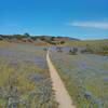
“A connector trail between Addington Road and Barloy Canyon Road that is a fun descent. ”


0.9
Miles1.5
KMDoubletrack
 Intermediate
Local Club: Monterey Off Road Cycling Association
Land Manager: BLM California - Hollister Field Office
 Best of Ord - Short
17.9 mi 28.8 km • 2,176' Up 663.12 m Up • 2,177' Down 663.56 m Down

 Salinas, CA
Creekside Ride to Outhouse and back via Goat.
Salinas, CA
Creekside Ride to Outhouse and back via Goat.
12.9 mi 20.8 km • 1,444' Up 440.04 m Up • 1,432' Down 436.57 m Down
Salinas, CA
 2020 Sea Otter Cross Country - Category 1
29.4 mi 47.4 km • 3,419' Up 1042.14 m Up • 3,412' Down 1039.86 m Down
Del Rey…, CA
Couch Canyon
4.8 mi 7.7 km • 733' Up 223.41 m Up • 732' Down 223.18 m Down
Circle Loop
18.5 mi 29.8 km • 1,259' Up 383.63 m Up • 1,269' Down 386.67 m Down
Santa Cruz, CA
 Wilder Ranch Coast Trail
14.3 mi 23.1 km • 144' Up 43.94 m Up • 144' Down 43.9 m Down
Santa Cruz, CA


0 Comments