MTB Project Logo

Uses a short connector trail to get the most out of the Bear Creek Trail.


Your Rating: Rating Rating Rating Rating Rating      Clear Rating
Your Difficulty:
Your Favorites: Add To-Do · Your List
Zoom in to see details
Map Key

14.8

Miles

23.8

KM

40%

Singletrack

2,804' 855 m

High

1,578' 481 m

Low

1,623' 495 m

Up

1,624' 495 m

Down

4%

Avg Grade (2°)

19%

Max Grade (11°)

Dogs Unknown

E-Bikes Unknown

Overview

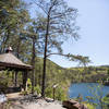
This route comes recommended by Cartecay Bikes of Ellijay, and for good reason. The ride uses all of the Bear Creek loop, and gives you the best of the downhill segments by using the P1 connector between upper and lower Bear Creek. This is great forest riding that includes some rocky technical sections, stream crossings, and secluded doubletrack. Sights include the huge old-growth Gennett Poplar Tree, and a spectacular viewpoint that overlooks the surrounding Chattahoochee National Forest.

Need to Know

There are several bike-friendly accommodations in the area including camping (on this very route), B & B's in the surrounding mountains, and also at Mulberry Gap Mountain Bike Get-A-Way.

Description

Start this ride at Forest Service Road 241 off of Gates Chapel Rd. Follow 241 up the road along Mountaintown Creek for approximately 1.9 miles where where you'll reach the Bear Creek parking area.

Stay left through the parking lot where the gravel road becomes trail. This section climbs moderately along the creek and has some rocks, but not many technical spots. Just past the parking lot the Pinhoti Trail merges from the left; stay right.

At 2.7 miles you'll reach the Gennett Poplar tree on the left of the trail and a good spot to pull off the trail and take a photo. Continue riding up the trail and turn right where the Pinhoti trail separates up the hill. This intersection is signed. The short section of singletrack does not get as much traffic as Lower Bear Creek.

When the trail merges with a doubletrack road (Upper Bear Creek), turn left here (later in the ride, youll be using this short segment again but turning right). After about .4 miles the Pinhoti will turn right; stay on the doubletrack and continue climbing. This grassy doubletrack road eventually comes to a fork. This ride stays right and follows an out/back to the Cohutta overlook. Staying left here starts the descent back and shortens the ride by 4 miles.

The route to the overlook is also considered Bear Creek Trail. Initially, it is more of the same...a grassy doubletrack road. Eventually, the doubletrack leads you to a creek crossing, and an intersection with Potato Patch Road (FSR 68). Bear Creek trail ascends in switchback form up the embankment to the right. This route follows the road since it is easier work and quicker to get to the overlook. Youll be coming down the switchbacks on the return. Follow the gravel road up hill for about a half mile to the overlook and there youll find great views of the Chattahoochee National Forest, Fort Mountain and Chatsworth, GA. After you are done taking it all in, continue up the road to the Bear Mountain trailhead, which will be on the right.

The section from the parking lot to the bottom is fun singletrack with some rolling jumps, and technical switchbacks. When you get to the bottom youll be at the intersection with the road again. Cross the creek to the same doubletrack you took before.

At the bottom of the doubletrack youll be back at the T-intersection. Stay right and go around the gate and enjoy some good forest singletrack. This section has some fast sections and more creek crossings and switchbacks. Be ready to turn left again on the P1 connector between upper and lower Bear Creek. This is a sharp left turn.

At the top of the climb take a right this time on upper Bear Creek and more doubletrack. After approximately 1 mile you'll go through a wildlife opening and the trail turns right and funnels into some singletrack. This final section of trail is some of the steepest and rockiest on the route. At the bottom, youll be at a large stream crossing of Bear Creek. Cross this, and head up the hill to the parking lot. To finish up, then take a left on FSR 241 back downhill to the start.

History & Background

This trail is maintained by the Ellijay Mountain Bike Association, a Chapter of IMBA. There are many options for rides here including combining Bear Creek with the Pinhoti 1, Pinhoti 2, and Pinhoti 3, which are local sections of the IMBA Epic long-distance Pinhoti Trail.

Contacts

Shared By:

Paul Stahlschmidt

Trail Ratings

  4.1 from 14 votes

#6

in Mulberry Gap

#1877

Overall
  4.1 from 14 votes
5 Star
36%
4 Star
50%
3 Star
0%
2 Star
14%
1 Star
0%
Recommended Route Rankings

#6

in Mulberry Gap

#39

in Georgia

#1,877

Overall
140 Views Last Month
7,535 Since Nov 15, 2015
Intermediate/Difficult Intermediate/Difficult

0%
7%
43%
7%
43%
0%

Photos

Overlook
Mar 20, 2021 near Cherry Log, GA
Great view at sunrise!
Dec 24, 2020 near Cherry Log, GA
Rewarding view after the long climb up the forest service road.
Jul 11, 2016 near Chatsworth, GA
That's one big Tree!
May 22, 2013 near Ellijay, GA
Huge Gennett Poplar Tree
Mar 20, 2021 near Cherry Log, GA
Bear Creek Overlook.
Mar 20, 2021 near Cherry Log, GA

0 Comments

Weather


Current Trail Conditions

Unknown
Add Your Check-In

Check-Ins

Jul 27, 2023
Dennis Short
Pretty boring ride. 40% singletrack - the rest is an old gravel logging road. Challenging because of 7 mile climb but that's it. 1 and done for me 14.5mi — 2h 00m
Oct 15, 2022
Christopher Lofton
Apr 2, 2022
Thomas Clark
Jun 12, 2021
Griff Rogers
Mar 6, 2021
Heath Ridley
Oct 8, 2020
Chaz Pattillo
Made a wrong turn when I hit the gravel road almost at the top, and descended to Barnes Creek Falls. Nice mistake, I recommend it. 16.6mi — 2h 45m
Nov 30, 2019
Amy White
Road southern part to connect gravel road to Pinhoti 1. Was fast doubletrack.
May 18, 2019
Francisco Rivera
8.2mi
Welcome

Join the Community

Create your FREE account today!
Already have an account? Login to close this notice.

Get Started