Dogs Leashed

E-Bikes
Unknown

Some of the trails in this area do not recover quickly from precipitation, especially in the colder months. Also, freeze-thaw is generally in effect in the winter months, so you'll need to get out early when the ground is frozen.
Overview
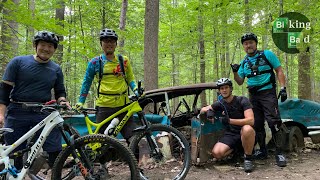
Woodstock 101 is an "Intro to Woodstock" ride that hits the major highlights in the Patapsco-Woodstock area. There is lots of sweet, flowy singletrack featuring the Patapsco Through Trail white blaze, nice views of the river, and several cool sites along the way. Most of the trails have been featured in recent races and epic ride events. These trails present a great alternative to the popular Avalon area which can get crowded on weekends.
Best ridden in the summer or fall months when the track is dry and the hoof prints have been smoothed out. Winter can be hit or miss, but good when the ground is frozen. Springtime often brings too much moisture, the trails get muddy and do not recover quickly.
Need to Know
Park at Woodstock Rock Trailhead, cross the bridge to enter the trail on your left just north of the river. (Church no longer allows parking).
There is a lot of equestrian activity in the area, with numerous nearby horse farms. Sometimes the horses are skittish, so be ready to stop and yield the trail, and talk to the riders - they may request that you dismount.
There are no facilities or water back in the woods, so bring with you what you need.
You may encounter wavyleaf basketgrass along the trail. This is an invasive species that PVSP is trying to contain. From September through December the grass blooms seed bearing spikelets that are sticky and attach to just about anything. Please take care to clean your bike, clothing, and gear of the seeds to help contain the invasive grass.
Description
Ride down the dirt road, continue straight to cross a small creek where the road veers right. Turn right up the trail and right at the T to the old Fox Rock Quarry, a now defunct granite quarry. There is a trail that loops fully around the quarry and is worth checking out when you have a chance, either on tires or on foot.
Continue the ride by following the trail to the right of the quarry. Through this stretch, the trail is fairly wide and beaten down, and can get muddy even in the driest of conditions. Keep an eye out for an old Chevy that was likely a victim of hurricane Agnes.
Eventually, at mile 1.5, you'll come out into a clearing on the edge of the Hernwood Landfill on your right. If you have a minute it's worth riding some 50 feet to the top of the hill to see the open field (though its probably not a good idea to eat the dirt in this vicinity). Back on the trail, this is the top of a very fun downhill stretch that takes you all the way down to the North Branch of the Patapsco River. You'll have a huge smile at the bottom of this one!
The next section is flat and twisty with the occasional log and lots of scenic views of the river. On the other side of the North Branch is the McKeldin area, and during the summer/fall months the river is typically shallow and rideable; you'll see a few crossings along the way. In addition to more singletrack, there are restrooms and facilities at McKeldin if you are in need during the warmer months (facilities are closed in winter).
Mile 3.5 begins a healthy climb away from the river that will reward with another fun, swoopy downhill that gets a bit chunky towards the bottom.
At mile 4.5, after crossing a wide, rocky creek, you'll be at the end of an access road that leads to Woodstock/Old Court Rd. Continuing along, you'll cross under Woodstock/Old Court Rd., go through some typically mucky spots, then begin riding the
Upper Thru Trail. The first section was completed in the summer of 2013 thanks to the efforts of hundreds of volunteers working with the Park through MORE. It is a fantastic addition to the trail system that takes you along the ridgeline on hand built bench cut.
The next several miles feature several steep grunts and fast, flowy downhills. The trails aren't technical but they are highly aerobic, so bring your climbing legs. A stop at the overlook around mile 7.7 is worthwhile for a breather and a snack. After riding through a powerline cut and up a washed-out climb, you'll have another fun downhill that takes you to a nice rocky ridge overlooking RR tracks next to the river at mile 9.1. We'll hang a right here, but if you were to continue along the trail, it would take you across the RR tracks and towards the Daniels Dam before hitting Alberton Rd, an old roadbed that is closed to vehicular traffic.
Follow the trail around to the right from the rocky ridge. You'll hit a gnarly, somewhat steep and loose climb that will take you away from the RR tracks to singletrack. Follow the track to
Switchback Trail, which features several switchbacks in a descent to a smooth creek crossing at the bottom. This takes you to the
Lower Thru Trail.
The
Lower Thru Trail is generally flat, twisty singletrack with logs and rock armored sections. It leads to a wide creek crossing, then a doubletrack section that is straight, flat, and fast, before going underneath the Woodstock/Old Court Rd bridge. After crossing the wide, rocky creek, you'll hang a right and continue straight along an old roadbed next to the creek. You can either continue on this old roadbed up to the Fox Rock Quarry, and then to the Church to complete the ride, or (better option), follow the track to take singletrack all the way back.
The ride will take you from 2-4 hours, depending on pace and stopping time. Definitely try riding the route in the opposite direction or as a figure eight. Several additional trails are detailed in the Woodstock 201 ride.
History & Background
You'll see the old Fox Rock Quarry, Herndon Landfill, a few abandoned cars and houses (victims of Hurricane Agnes), and lots of nice views of the Patapsco River. There were many granite quarries in the area, hence the nearby town name, Granite.
Contacts
Shared By:
PedalToThe Mehtal
with improvements
by Kent G

 Continue with onX Maps
 Sign in with Facebook


 Intermediate/Difficult

 West Friendship Park


 Middle Patapsco
 Seminary Cross Country Tour
 Gut Check Grinder Tour
")


0 Comments