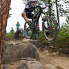
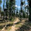
“Gateway to some upper elevation trails. ”
2.0
Miles3.2
KMSingletrack

Local Club: Central Oregon Trail Alliance (COTA)
Land Manager: USFS - Deschutes National Forest Office
 Funner-Tiddlywinks
13.4 mi 21.6 km • 1,133' Up 345.47 m Up • 1,135' Down 345.98 m Down


 Deschut…, OR
 Mrazek, Farewell, Skyliner, Whoops, Phil's Loop
31.1 mi 50.0 km • 2,574' Up 784.54 m Up • 2,687' Down 818.92 m Down


 Bend, OR
 Entrada River Loop
3.0 mi 4.8 km • 253' Up 77.17 m Up • 260' Down 79.35 m Down


 Deschut…, OR
 Flagline
12.1 mi 19.5 km • 1,340' Up 408.45 m Up • 1,336' Down 407.35 m Down


 Deschut…, OR
 Sunriver River Loop Path
4.9 mi 7.9 km • 25' Up 7.53 m Up • 25' Down 7.55 m Down


 Sunriver, OR
 Maston Outer Loop
12.2 mi 19.7 km • 371' Up 112.94 m Up • 372' Down 113.46 m Down


 Redmond, OR


1 Comment