
 Continue with onX Maps
 Continue with Facebook


 Difficult

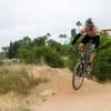
“The "easier" climb up! ”


0.7
Miles1.2
KMSingletrack
 Difficult
Local Club: San Diego Mountain Biking Association (SDMBA)
Land Manager: City of San Diego - Parks & Recreation
 Parking lot to E-Ticket and Back
4.6 mi 7.5 km • 530' Up 161.56 m Up • 559' Down 170.44 m Down

 Santee, CA
 Sweetwater River Trail with Tiki Loop Turnaround
12.9 mi 20.7 km • 859' Up 261.7 m Up • 859' Down 261.84 m Down
SDMBA Summit Park and Bonita Golf Course loop
4.4 mi 7.1 km • 324' Up 98.79 m Up • 326' Down 99.38 m Down
La Presa, CA
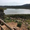
San Dieguito River Park - Bernardo Bay/ Piedras Pintadas Trail
8.2 mi 13.2 km • 570' Up 173.78 m Up • 567' Down 172.96 m Down
Lake Hodges North Side
10.2 mi 16.4 km • 294' Up 89.75 m Up • 294' Down 89.75 m Down
Escondido, CA
 Coast to Crest Trail - North Shore Lake Hodges
15.6 mi 25.1 km • 407' Up 124.16 m Up • 407' Down 124.16 m Down


0 Comments