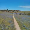
“A short climb out from the parking lot with a good view along the way. ”
0.5
Miles0.7
KMSingletrack

Local Club: Monterey Off Road Cycling Association
Land Manager: BLM California - Hollister Field Office
 Best of Ord - Short
17.9 mi 28.8 km • 2,176' Up 663.12 m Up • 2,177' Down 663.56 m Down


 Salinas, CA
 Pipeline Loop
9.3 mi 14.9 km • 1,616' Up 492.63 m Up • 1,616' Down 492.47 m Down


 Salinas, CA
 Inter-Garrison Rd to Kyle's Bench loop.
8.7 mi 14.0 km • 468' Up 142.59 m Up • 486' Down 148.13 m Down


 Marina, CA
 Road Runner to Razorback
5.2 mi 8.4 km • 702' Up 213.88 m Up • 702' Down 214.09 m Down


 Ridgemark, CA
 Wilder Ranch Singletrack Loops
14.1 mi 22.7 km • 1,487' Up 453.27 m Up • 1,477' Down 450.15 m Down


 Santa Cruz, CA
 Wilder Ranch Coast Trail
14.3 mi 23.1 km • 144' Up 43.94 m Up • 144' Down 43.9 m Down


 Santa Cruz, CA


2 Comments