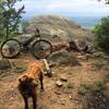
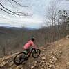
“A fast, sometimes technical descent back to Griffith Branch Trailhead. ”
2.2
Miles3.5
KMSingletrack

Local Club: SORBA - Tri-Cities
Land Manager: USFS - Cherokee National Forest - Nolichuky-Unaka Ranger Station
 Bartee Branch Loop
19.5 mi 31.4 km • 3,126' Up 952.66 m Up • 3,075' Down 937.23 m Down


 Hunter, TN
 Watershed Trails
4.4 mi 7.0 km • 906' Up 276.21 m Up • 922' Down 281.06 m Down


 Hampton, TN
 Sugar Glider Loop
9.3 mi 15.0 km • 1,797' Up 547.59 m Up • 1,794' Down 546.71 m Down


 Bristol, VA
 Buffalo Mountain Trail Out-and-Back
28.9 mi 46.5 km • 3,922' Up 1195.37 m Up • 3,921' Down 1195.17 m Down


 Unicoi, TN
 Buffalo Mountain Fire Tower
13.5 mi 21.7 km • 1,944' Up 592.49 m Up • 1,876' Down 571.75 m Down


 Unicoi, TN
 Virginia Highlands Loop
74.8 mi 120.3 km • 6,737' Up 2053.31 m Up • 6,738' Down 2053.59 m Down


 Glade S…, VA


0 Comments