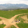
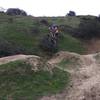
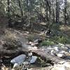
“A bit of climbing to get to it, but worth the effort! ”
2.8
Miles4.6
KMDoubletrack

Land Manager: USFS - San Bernardino National Forest Office
 Loch Leven Loop
21.2 mi 34.1 km • 3,012' Up 918.12 m Up • 3,012' Down 917.99 m Down


 Yucaipa, CA
 Lord of the Ridges Loop
6.2 mi 9.9 km • 790' Up 240.84 m Up • 793' Down 241.82 m Down


 Loma Linda, CA
 Jedi Tree and Back
4.2 mi 6.7 km • 484' Up 147.51 m Up • 497' Down 151.54 m Down


 Loma Linda, CA
 Santa Ana River Trail (SART) 2E03 Shuttle
13.7 mi 22.1 km • 1,300' Up 396.14 m Up • 1,782' Down 543.24 m Down


 Big Bea…, CA
 NICA SoCal HS Cycling League: Beach to Boulders Race Course (2019)
5.7 mi 9.1 km • 421' Up 128.42 m Up • 423' Down 128.96 m Down


 Lakeview, CA
 Southridge XC Course
5.8 mi 9.3 km • 710' Up 216.56 m Up • 708' Down 215.71 m Down


 Glen Avon, CA


0 Comments