Dogs Leashed

E-Bikes
Unknown
Overview
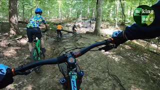
A popular loop with in-the-know locals looking to get away from the weekend crowds at Avalon, this route features miles of flowing singletrack through the historic areas of Daniels and Woodstock.
This loop is generally non-technical but physically challenging with numerous short and steep climbs in and out of the stream valleys that feed into the Patapsco River, your constant companion on this trip.
At times, you'll feel like you're deep in the backcountry despite suburban neighborhoods just minutes away. Look for remnants of abandoned mill towns, farming communities, and stone quarries trailside along the route.
Need to Know
This route has numerous parking options, a good thing since parking can be at a premium during the warmer summer months, not only with mountain bikers but with fishermen, hikers, and canoers. If the lot by the green metal bridge is full, there is another small parking area just off Dogwood Road (
Alberton Road). If this is full, you can park at the large parking area at the bottom of Daniels Road near Daniels Dam. If these are all full, then you'll need to park in one of the area neighborhoods and ride in to the trailhead.
There are no facilities or water fountains along the route, though you'll pass right by the Woodstock Inn on Woodstock Road at the halfway point of the route. Fast riders may complete the loop in two hours, but most mortals will require more than three hours so bring adequate water and nutrition.
Cell phone reception in the valley can be poor. If you find yourself in a pickle, heading away from the river will always lead you to neighboring houses.
Description
Within 100 feet of the trailhead, you'll begin a steep, but relatively short, singletrack climb that will set the tone for the ride; there will be many more climbs just like this. But fear not, this first climb is one of the steeper ones, and there are plenty of downhills to make the climbs worth your while. Just a warning to pace yourself and not to burn too many matches, especially early in the ride.
The first section takes you from Old Frederick Road into the Daniels area on the
Daniels Access Trail, paralleling an active railroad line for a bit before turning away from the river to ride a pair of the Church Loop trails and descending to Daniels Road.
After riding down and then crossing Daniels Road, you'll cross a small creek then follow the
Switchplate Trail for a nice climb and descent to the
Old Main Line Trail, a flat doubletrack trail alongside the Patapsco. Soon, you'll be back on singletrack as you follow the
HoCo Thru Trail into the Woodstock area, eventually reaching Woodstock Road by the Woodstock Inn, a biker bar that is very welcoming to mountain bikers and outdoors enthusiasts.
Ride across the Patapsco on Woodstock Road/Old Court Road, then make an immediate left onto an access road with a gate that is almost always closed. Drop down onto the
Thru Trail which will take you back under Woodstock/Old Court Road, then follow the MORE Fun
Ridge Trail to the
Thru Trail as you head downstream, though the river will be out of sight for several miles.
There are a few big climbs through this section but now is the time when you can start burning matches. The climbs will reward you with really fun descents, including the downhill to the railroad tracks that is one of the best in Patapsco.
After the singletrack fun ends, you'll ride by Daniels Dam and the remains of an old church before riding underneath a railroad bridge. Soon, the often sandy dirt trail becomes
Alberton Road, and old roadbed closed to vehicular traffic.
You'll pass more old house foundations and a cliff popular with area climbers.
Alberton Road takes you to Dogwood Road and Hollowfield Road, which becomes Old Frederick Road at the green metal bridge. Take care riding on these roads as the streets are narrow and the road can be crowded.
Ride the route in either direction. Locals typically add bonus miles in Woodstock and possibly McKeldin before looping back on the
Thru Trail.
History & Background
The Daniels area is rich in history as it was once a bustling mill town in the 1840's but destroyed by Hurricane Agnes in 1972. You'll encounter trailside remnants of the old town, such as old house foundations, and many of the trails ride on old roadbeds used by the mill town, area farms, the railroad, and various stone quarries many years ago.
If you have time and want to explore, the Daniels Dam, at the bottom of Daniels Road, and the Gary United Methodist Church, just around the corner of the dam, are worth checking out and snapping a few photos.
Contacts
Shared By:
PedalToThe Mehtal

 Continue with onX Maps
 Sign in with Facebook


 Intermediate/Difficult

 Woodstock 101

 Randall…, MD
 West Friendship Park
 Ruxton-Roland Loop
")


0 Comments