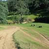
“An old mining and ranch road that's mostly flat and easy with one really steep ridge descent/climb. ”
4.9
Miles7.9
KMDoubletrack

Land Manager: East Bay Regional Park District (CA)
 Mt. Diablo - Mitchell Canyon Ascent
13.4 mi 21.5 km • 3,018' Up 919.89 m Up • 3,018' Down 919.84 m Down


 Clayton, CA
 Around Round Valley
7.6 mi 12.2 km • 474' Up 144.58 m Up • 474' Down 144.38 m Down


 Byron, CA
 Volvon Loop
9.3 mi 14.9 km • 1,222' Up 372.52 m Up • 1,222' Down 372.32 m Down


 Blackhawk, CA
 Dan Cook, Wall Point Loop
11.3 mi 18.2 km • 1,558' Up 474.84 m Up • 1,557' Down 474.64 m Down


 Diablo, CA
 Brushy Peak: Main Loop Ride
4.8 mi 7.8 km • 864' Up 263.38 m Up • 865' Down 263.5 m Down


 Livermore, CA
 Tilden Park Inspiration Loop
8.7 mi 14.1 km • 828' Up 252.44 m Up • 848' Down 258.38 m Down


 Kensington, CA


0 Comments